Photographing Newfoundland - Part II
Bonavista Peninusula to Fogo Island
By Dr. Robert Berdan
June 24, 2013
After driving the Avalon Peninsula on our 4th day in Newfoundland we stopped overnight in Clarenville. Clarenville is a small town of about 6000 that services about 90,000 inhabitants in the surrounding communities within a 100 km radius. We stayed at the Restland hotel on the main street as we were happy to get off the Trans Canada highway. The Transcanada highway is a modern roadway, smoothly paved with trees cut well back to reduce the chances of hitting a moose, but I saw very few opportunities for taking photographs. From Clarenville we drove on highway 230A which then joined with 230 and headed north for Trinity East. and Port Rexton. The area along the coast was picturesque with small fishing villages and hilly terrain. We wanted to stay in the Trinity area for a few days and explore the area more thoroughly. We drove a little further north and decided to get a room in Catalina at the Seaport Inn Hotel & Restaurant because it offered a restaurant where we could get breakfast and was centrally located with respect to the towns we wanted to visit on the Bonavista peninsula. We had checked on some rooms in Trinity East, and liked the Artisan Inn as it was right on the ocean, but the cost was $189\night which was just a bit high for our budget so we enjoyed breakfast there one morning and looked elsewhere for accomodation. The Harbour around Trinity east is beautiful and offered many photo opportunities.
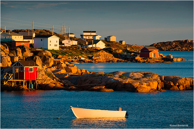
Trinity East, in the background the cliffs form part of the Skerwink Trail (70-200 mm lens)


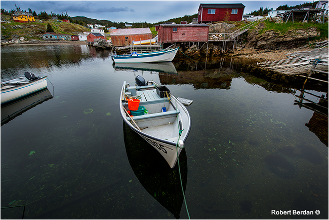
Trinity East

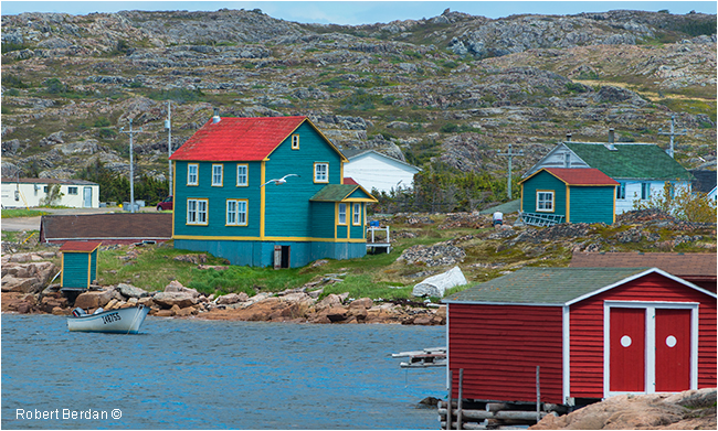
Artisan Inn is the red building in the foreground, we could have stayed in the blue house which we were told
belongs to an Alberta Politician, but cost was just a bit high for us.

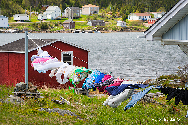
Colourful clothes line and homes next to the Artisan Inn in Trinity
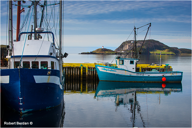
Trinity Bay Fishing boats with the Fort Point Lighthouse in the background

Fort Point Lighthouse Trinity Bay (300 mm telephoto lens).
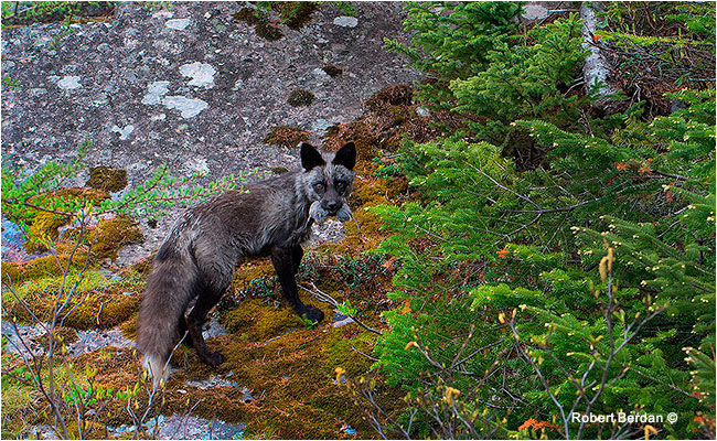
I photographed a gray fox with a vole in its mouth along side the road driving back from Fort Point Lighthouse on Trinity
Bay. Nikon D800- 70-200 mm lens
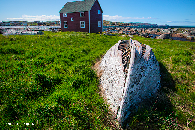
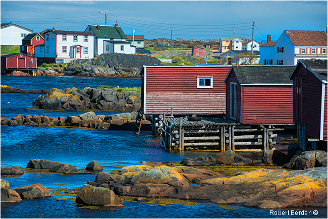
New Bonaventure (14-24 mm lens)

Lobster traps New Bonaventure (14-24 mm lens)
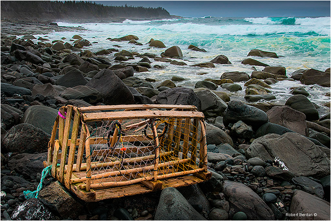
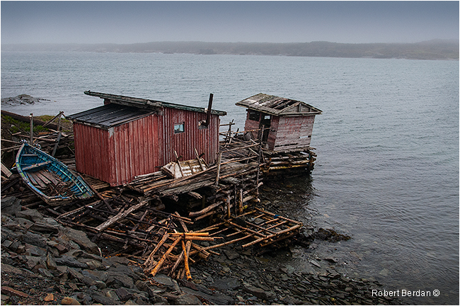
Lobster traps are constructed of wire and wood and can hold several lobsters. Bait, usually fish or chum is placed inside the trap and the traps are dropped onto the sea floor. A long rope is attached to each trap, at the end of which is a buoy that bears the owner's license number. The traps are checked every other day and if necessary re baited. Lobster traps were invented in 1808 by Ebenezer Thorndike (Wikipeda). We found two Lobster traps on the seashore which we presume were blown there by a storm (see onen below).
Lobster trap I found washed up on a beach shore south of Amherst Cove. It may appear as though I placed the trap here on the beach as a prop, but I assure you I didn't and I left it were I found it.
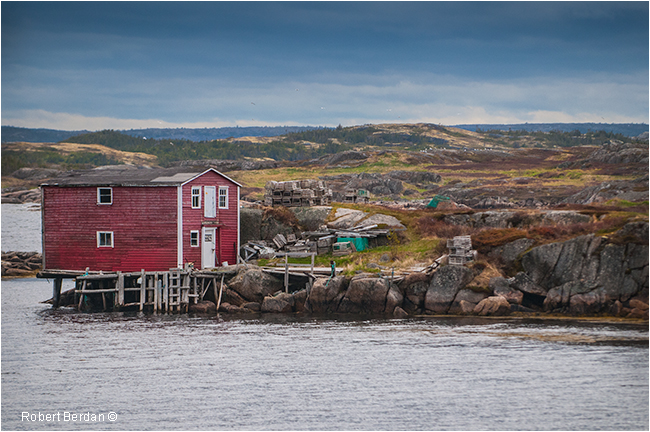
Catalina, Port Union and Elliston
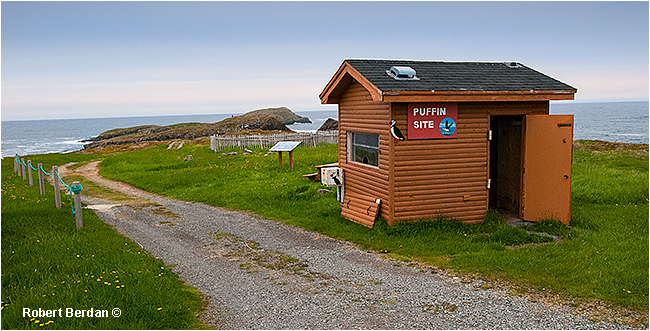
We stayed two nights in Catalina as it was located close to Trinity, Elliston and Bonavista. Catalina was amalgamated with Melrose and Port Union to form the town of Tinity Bay North. Port Union contains numerous historical buildings and the town is the "Only Union Built Town" in North America, and was founded by William Coaker in 1916. It was the headquarters of the Fisherman's Union. In the Newfoundland Tourism guide Elliston is described as the root cellar capital of the world. While I photographed many of the root cellars, what they don't mention is that Elliston has a small island isolated from the mainland by about 20 meters that hosts a puffin colony. A short easy 0.5 km hike and you can sit and watch and photograph the puffins. On my first visit the puffin colony, there were only about a dozen puffins visible. When I returned the next morning there were hundreds. I sat at this location for several hours while watching and photographing the puffins. As the caplin, a small fish belonging to the smelt family, had not yet arrived I wasn't able to photograph a puffin with fish in its mouth. Capelin can arrive in Mid to late June and attract whales and seabirds..
Entrance to Bird Island, a sign asked for donations though it did not indicate how such donations might be used.
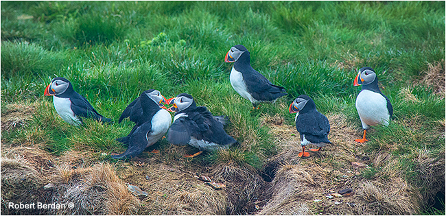
Puffins on Bird Island Elliston
Puffins taking flight from small island near Elliston
Puffins squabble on Bird island in Elliston
Atlantic Puffins (Nikon D800, 300 mm f/2.8 lens + 1.5X teleconverter)
One minute video of Puffins nesting on Bird Island Elliston, Newfoundland - requires Flash player.
I am sitting across from Bird Island in Elliston - it was an easy short walk to this vantage from where I could watch and photograph nesting puffins for hours. There are steep cliffs that isolate the island from predators and people.
Elliston has approximately 300 nesting pairs of puffins sometimes called a "sea parrot" because of its colourful beak. Both sexes have similar colouring although males tend to be slightly larger. Puffins can dive up to 70 m (200 feet) deep where they hunt for small fish, including herring and capelin. They establish their burrows on grassy cliffs. They spend only about 5 months of the year on land in order to nest. Both parents take care and feed the young. At fledging, the young puffins leave their burrows and fly out to sea, they can live up to 20 years. We saw a small shop at the head of the trail asking for donations though it's not clear what the donated money would be used for. View additional video clips of the puffins from Elliston's web site here.


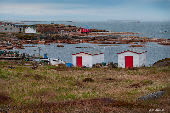
Boats in Elliston, Bird island is at the top right of the picture.
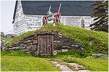
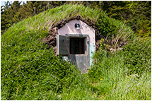
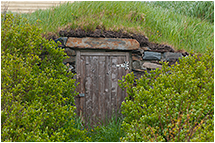
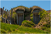
Elliston - Root Cellar Capital of the World
 |
 |
 |
 |
 |
 |
 |
 |
 |
 |
 |
 |
Root cellars are structures built underground or partially underground using stone, wood, cement and sod. Elliston is reputed to be the root cellar capital of the world with more then 135 root cellars in the community. Root cellars keep a constant temperature that keeps vegetables and preserves cool in summer and prevents them from freezing in winter. I found root cellars throughout the island in many small communities and because of my fascination with them I took more then a dozen photographs some of which are shown above. To view a short video about root cellars by the Newfoundland and Labrador tourism watch this short Youtube video.
Bonavista and Spillers Cove
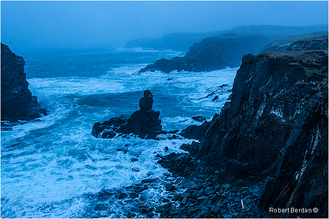
Bonavista is at the tip of the peninsula and is built largely on flat land and boasts a population of about 3800. John Cabot first landed here in his ship the Mathew in 1497. The Bonavista lighthouse is an attraction and has a small adjacent island with Puffins though we did not see any. South of the lighthouse is Dungeon Provincial Park and Spillars Cove that features several large sinkholes where the ocean can be seen washing inside and the coast is made up of spectacular cliffs. There is a rough dirt road through the park with horses and cattle grazing on the grass in the adjacent fields. The lighthouse was often covered in fog while we were there and includes a small gift shop that sells post cards and other souvenirs.
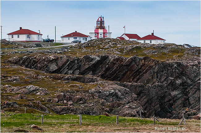
Bonavista Lighthouse

View looking north from the Bonaviasta Lighthouse
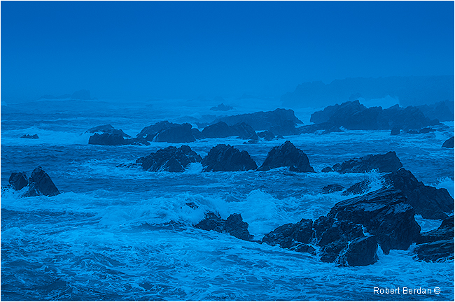
Spillars Cove near Bonavista
Spillars Cove near Bonavista
Short movie clip of Spillars Cove
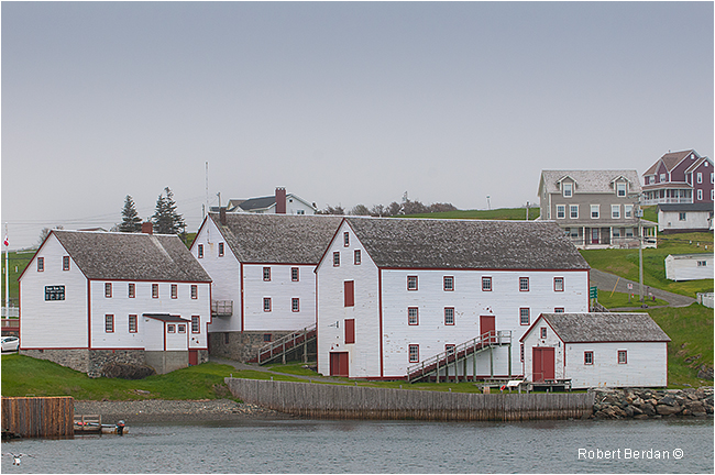
The Ryan Premises is a National Historic Site of Canada located in the town of Bonavista, Newfoundland. It is preserved as an example of a large-scale merchant operation in a Newfoundland outport. The site consists of the proprietor's house, a carriage shed, a retail shop, a retail store, a fish store and a salt store. The staff house, adjacent to but not part of the historical site, is a Registered Heritage Structure. Earlier, the premises included a larger salt store, a cooperage, a powder magazine, a telegraph office, wharves, fish flakes, a lumber yard and a shipyard (source Wikipedia).
Terra Nova National Park
While driving through Terra Nova National park along the Transcanada highway we did not see much worth stopping for though we stopped in the park office and the parsk staff were just preparing for the upcoming season. On the drive out of the park office I stopped to photograph some flowers and lichen alongside the road with my 60 mm macro lens - after all I brought it with me and needed to justify carrying it - see images below.
Lichen Cladonia sp (Nikon D800, 60 mm macro lens).
Rhodora Rhododendron canadense a flowering shrub native to northeastern North America (60 mm macro lens)
Unidentified wildflowers growing on the cliff side of Bird Island (300 mm lens)
Bunchberry (Cornus canadensis) flowers on tree stump (Nikon D800, 60 mm macro lens).
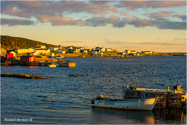
Gambo to Musgrave Harbour
North of Terra Nova National Park we reached Gambo where we headed up highway 320 to follow the coastline up to New-Wes-Valley, Newtown, and Lumsden before finally reaching Musgrave Harbour where we stayed overnight in an efficiency unit with a view of the bay. There were many places to stop and take photographs, each town felt isolated and lonely, but with a unqiue character of its own.
Fishermans stage and dock
Near Newtown - the landscape had only a few short trees and the ground was mostly rock covered in grass.
Newtown
Newtown - this location is also featured in one of the Newfoundland Tourism videos and 2012 tourism book cover
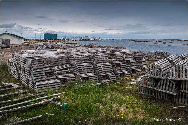
Lobster traps piled up around the bay at Musgrave Harbour - for the most part the town area is flat and lacks the hilly terrain we found in many of the other small coves.
Musgrave harbour before sunrise
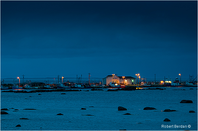
Musgrave Harbour at night after sunset
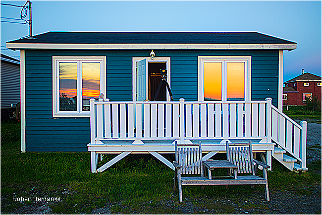
Efficiency unit we stayed in overnight in Musgrave Harbour faced the ocean, I have my tripod set up on the deck and the sunrise can be seen reflected in the windows. Both pictures above were taken from the deck.
Unlike most of the other communities, Musgrave harbour was a relatively flat area where the wind from the ocean blew
directly onland. The harbour appeared to be "man-made" and sheltered about a dozen small fishing boats. We discovered both rocky and sandy beaches in the area though the water is likely to be too cold for most of us to consider swimming in. There were two small stores in town where we picked up some groceries. In the morning I watched a local fisherman take out his dory into the protected harbour.
Farewell Ferry to Fogo Island
A few hours from Musgrave harbour is Farewell that has a ferry that travels regularly to the Change Islands and Fogo island. During the wait I decided to have fish and chips for breakfast from a small trailer parked nearby. While we waited at the dock we watched Gannets dive for fish in the bay and spoke with some of the locals and also some of the tourists many of whom were from Ontario. We weren't sure how hard it would be to book a room on Fogo Island so my friend Kamal called ahead and booked the first motel that is on Fogo dockside, but upon seeing it we decided to drive into Fogo to see if we might get better accomodations as there is nothing to photograph where the ferry unloads. The ferry ride takes approximately an hour, though it may take longer if it stops at the Change islands. Once on the island we drove north to Fogo which was about a 20 km journey. The terrain on both sides of the highway consisted of tundra with many small ponds and short stumpy pine and tamarack trees. Fogo island is the largest offshore island being about 25 km by 14 km in size. Fogo Harbour and Tilting Harbour were the first settlements on the island. Beothuk Indians traversed the island for hundreds of years before the Irish and French settled here. In 2006 the cenus indicated there were 2,706 people living on the island.
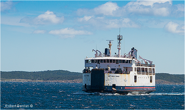
Ferry boat "Tthe Captain Earl Windsor" took us to Fogo island in about an hour
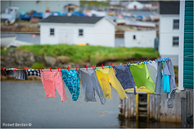
Clothes line in Seldom, a small community near the ferry dock on Fogo Island.
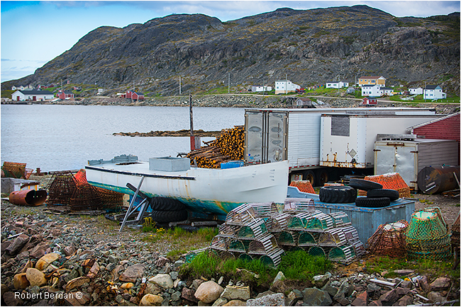
Boat under repair, lobster traps, crab pots and wood pile in Seldom, Fogo Island
Fogo with view of Little Harbour
Clothes lines are everywhere and its no wonder so many photographers and artists include them in their work.
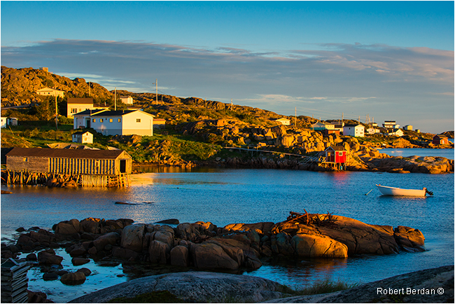
Protected Harbour Fogo Island
Coming into Fogo along the main drag at night, We stayed in an efficiency unity next the first telephone pole.
Fogo harbour as it appeared from the backyard where we stayed.
Church and cemetary on the main street in Fogo. The grave stones are lit by a street light behind me. This church was just a short walk from where we stayed. 14-24 mm zoom lens on a tripod.
Fogo and church at night taken from harbour front (14-24 mm zoom lens on tripod).
Terrain outside of Fogo - showing the tundra like landscape at sunrise. The island features Caribou which I looked
for but could not locate during my stay. .
Deep Bay Fogo Island around sunrise (70-200 mm lens).
Deep Bay Fogo island after sunrise (70-200 mm lens).
Deep Bay Fogo Island around sunrise
Fogo Island Inn under construction near Joe Batt's arm. The hotel has 29 rooms starting at over $500 per night - maybe Bill Gates and Warren Buffet could stay there but certainly not your average folk. View more information about the Fogo Island Inn here.
Joe Batt's arm is a small community on the east side of the island, note the small green out house that dumps into the ocean.
Tilting is another small community on the east part of Fogo Island - I was attracted to the white picket fence.
One of many old style fences we saw on Newfoundland which are used to keep livestock like sheep protected.
Dory that had its day
Homes and fishing huts built on the rocks in Titling
Water front property in Tilting, Fogo Island
Island Harbour on the West side of Fogo Island around sunset
On our journey to Fogo island we left Farewell in bright sun but when we landed on Fogo island an hour later it was cloudy and rainy. As we drove to the north part of the island the sky cleared and we experienced two days of sunshine. Most of the photos I took I used a 70-200 mm lens and a 14-24 mm lens for wide landscapes. The landscape has very few trees and those we did encounter were short pines, tamrack or windswept tucamores. In two days we traversed the island several times, but in spite of seaching and locals telling us where to look for Caribou we couldn't find any. According to this Youtube video there are quite a few Caribou living on the island. Before we knew it we were back on the Ferry headed to the main land and then to Twillingate. I will describe our experiences in Twillingate and Gros Morne National Park in the third and final article on Photographing Newfoundland.
Some suggestions I have for photographers is always photograph signs on entry to the towns or names of rivers, bridges etc because if you bring back thousands of images like I did it is easy to forget where a specific image was taken. Thankfully I am able to identify many of the locations because the photographs flow in a linear timeline and I know the route we took. I am thinking a GPS device for my camera might be a good investment in the future for trips like this. .


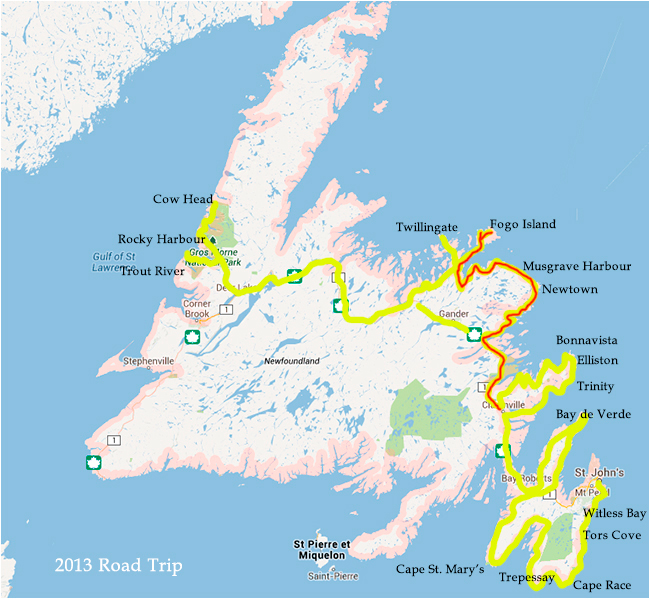
Map showing region we drove From Clarenville to Fogo Island covered in this article
We drove over 3400 Km (marked in yellow) in 2 weeks exploring Newfoundland - most of the time we hugged the coastline. The red line indicates the route we took in the second part of our journey through Newfoundland. On the map I have also marked some of my favorite towns and locations. To view a google interactive map of Newfoundland click here.