
Calgary to Tuktoyaktuk via the Dempster Highway
by Dr. Robert Berdan, Kamal Varma and Donna Berdan
September 21, 2025 (last updated March 25, 2026)
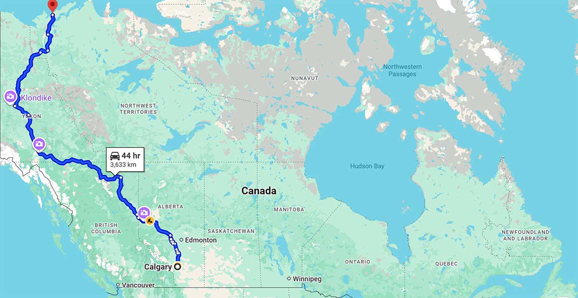
Google map showing our route from Calgary to Tuktoyaktuk a 7,000 km return trip
Tuktoyaktuk is an Inuvialuit community in Canada's Northwest Territories, located at the end of the Inuvik–Tuktoyaktuk Highway on the Beaufort Sea coast (red balloon at the top of the map). The community is as far north as you can drive in Canada. Tuktoyaktuk means "place resembling a caribou," the community is known for its unique landscape featuring pingos which are permafrost ice-cored hills, 3–70 m (10–230 ft) high and 30–1,000 m (98–3,281 ft) in diameter. They are typically conical in shape like small volcanoes and they grow in height. To get to Tuktoyaktuk there is only one dirt road - the Dempster highway which travels across the Arctic circle and futher north. It's a rough road that passes through some beautiful landscape. We describe our trek north to Tuktoyaktuk from Calgary, Alberta an approximately 7000 km (4349 miles) round trip.
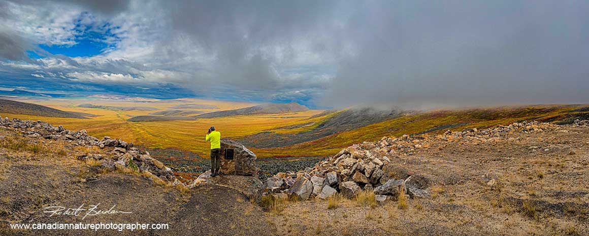
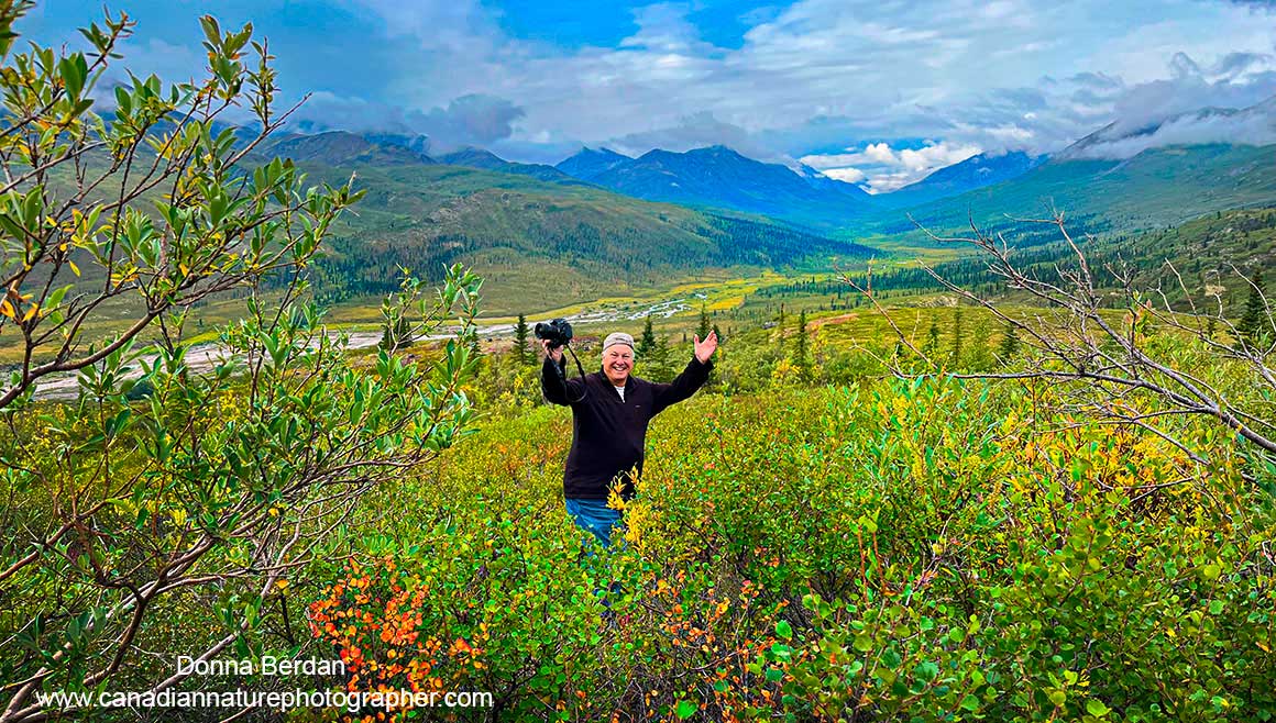
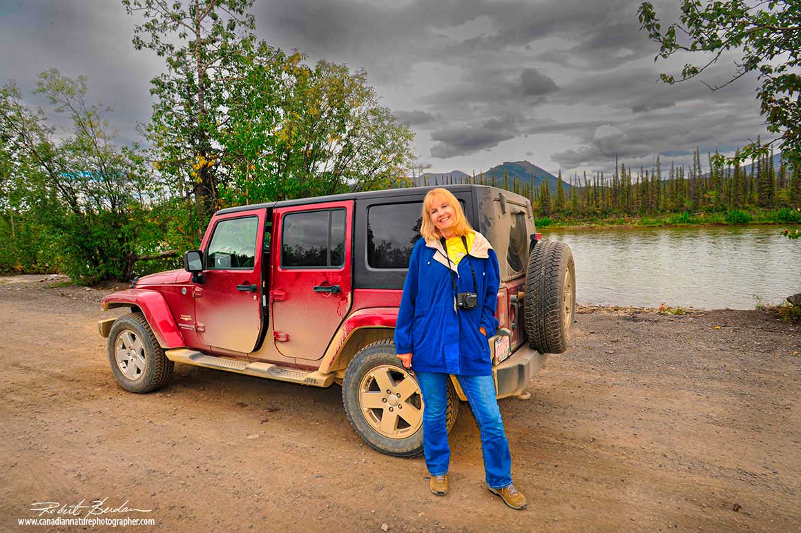
Kamal Varma above the Dempster highway at Wrights Pass.
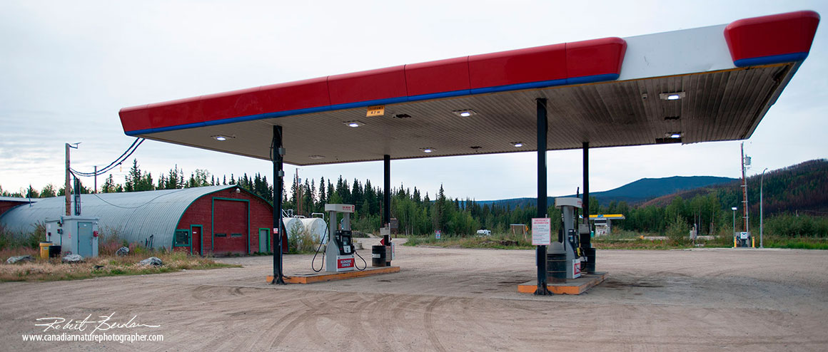
Automated gas pump is located at the entrance to the Dempster highway.
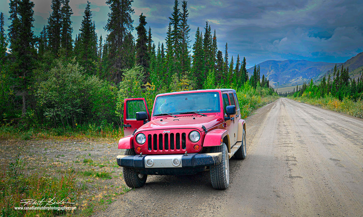
We travelled using a Jeep Wrangler which in our opinion is the perfect vehicle for this trip, however vehicles that offer accomodation and cooking are also suitable. There were several folks driving motorcycles, but it made us wonder how comfortable they were with the dirt, rocks, sand, and insects. Photo above was taken just north of the Tombstone visitor center.
When we started driving the dempster we first crossed a small bridge which turned into a dirt road. The Dempster later became rougher and full of pot holes. The road was surrounded by boreal forest on both sides in places. We stopped at the Tombstone park visitor center at 72 km which has washrooms, a small exhibit, pamphlets and books. Driving out the parking lot and heading north we went up hill and viewed some nice scenery in the valley on the left side of the road with mountains and valleys.
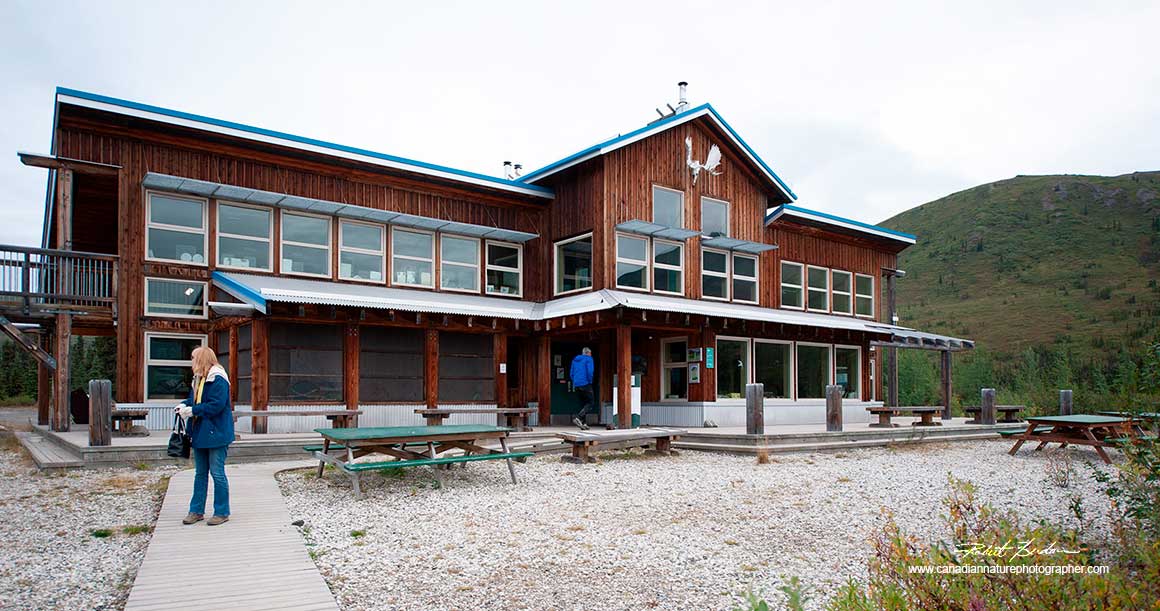
Tombstone visitor Center near the entrance of the Dempster Highway (72 km) offers exhibits, pamphlets and information about the Dempster. Open from May 17 to September 21, 2025, 9 am to 5 pm.
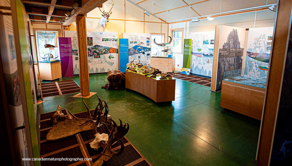
Inside the Tombstone visitor center features a number of exhibits.
If planning to drive this route, it is important to have your vehicle thoroughly checked before you go and bring a spare tire. I purchased new tires before the trip and some folks recommended bringing two spare tires. We also brought a fire extinguisher, insect repellant and bear spray. There are campsites along the Dempster but we choose to stay at accomodations along the route where we could purchase food and sleep in comfort. Our navigator, Kamal Varma, took care of booking rooms for us. As far north as Dawson city the road was paved, though often narrow and many parts of the highway were under construction slowing our passage. There was also a short section of pavement leading into and out of Inuvik. We brought food, water and our camera gear.
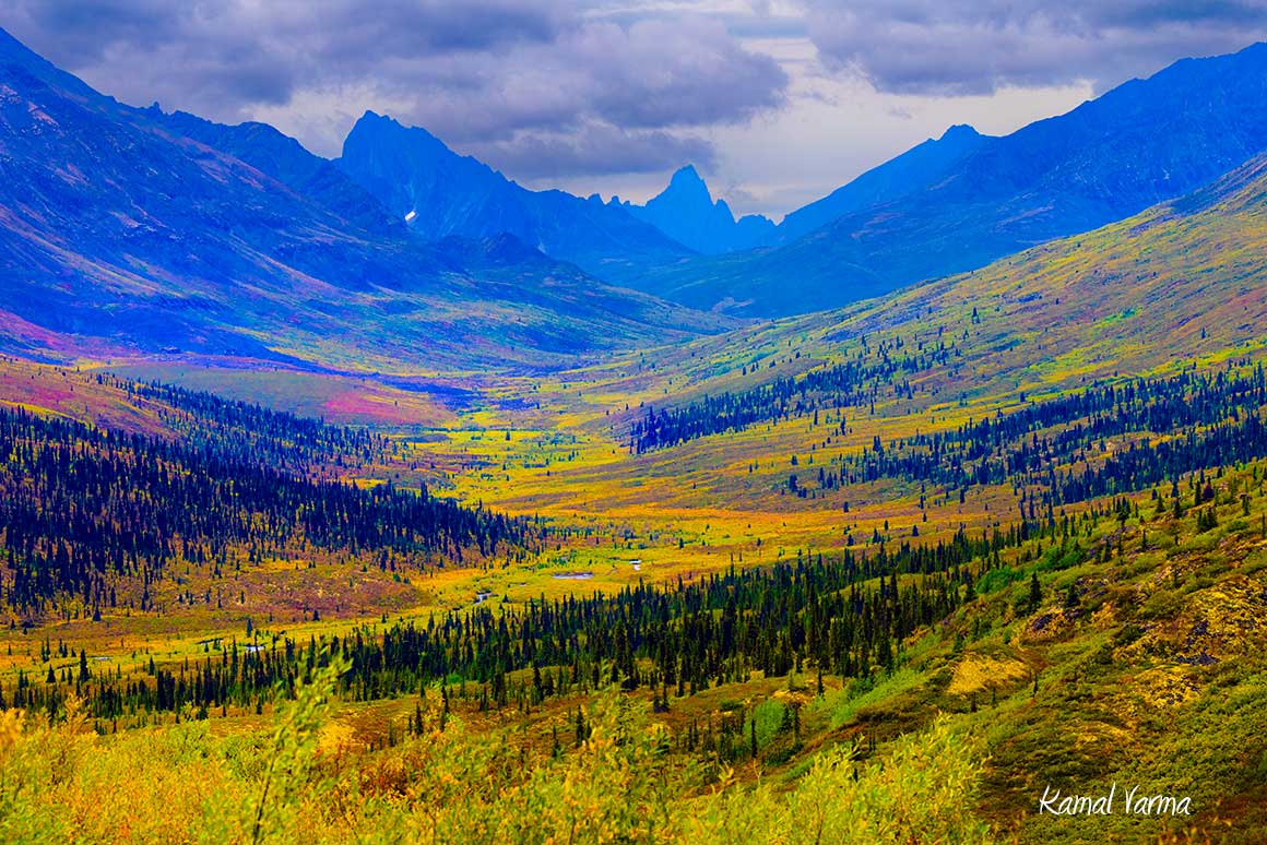
First view after leaving Tombstone visitor center from a hill overlooking the valley next to the highway.
We started planning this trip in January of 2025 and made some bookings for accomodation in February at Eagle Plains and Inivuk. Distances between gas stations in remote Canadian communities can be 400km or more so be sure to fill up at each opportunity. We drove the route from Calgary to Tuktoyaktuk between August 16 and returned home to Calgary on August 27. We chose these dates as we knew we would have 16 hours daylight or more in the north, the Tundra would be starting to change colour around end of August and black files are reduced when the nights get cooler. We had hoped to photograph the Aorura, but the sky was too bright on most nights. The Dempster highway (a dirt road) starts about 40 km outside of Dawson city in the Yukon and ends in Tuktoyaktuk on the Arctic ocean. The road to Tuktoyaktuk was first opened in November 2017.
Robert doing what he loves best - taking nature pictures.
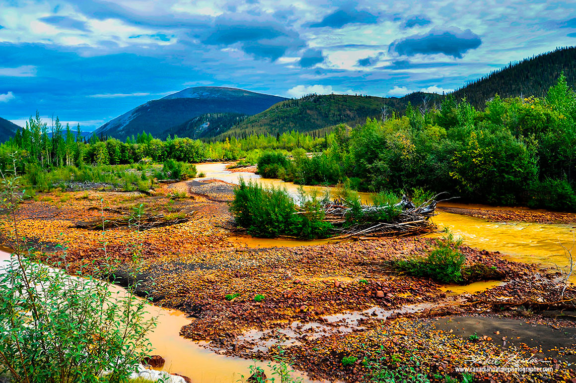
Rusty coloured river (East Blockstone) next to the Dempster highway.
Donna Berdan resting at a pull over next to the North Klondike river along the Dempster.
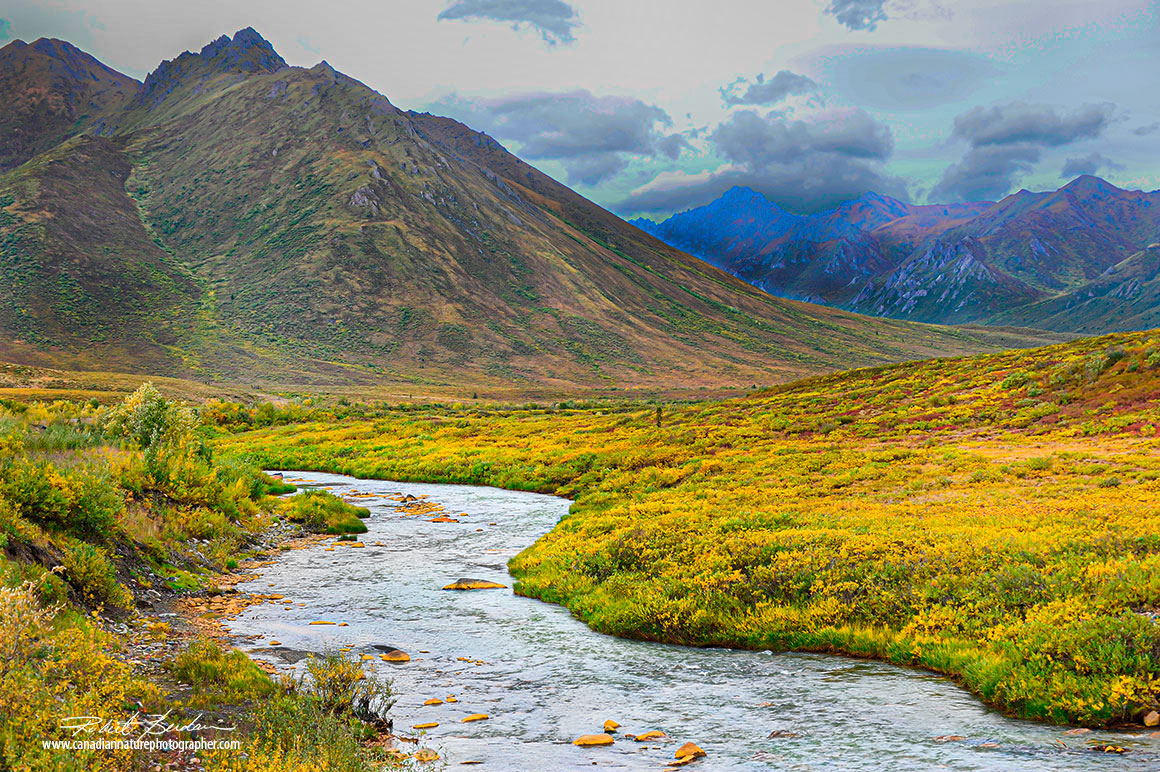
North of the visitor center we captured mountains and streams next to the highway.
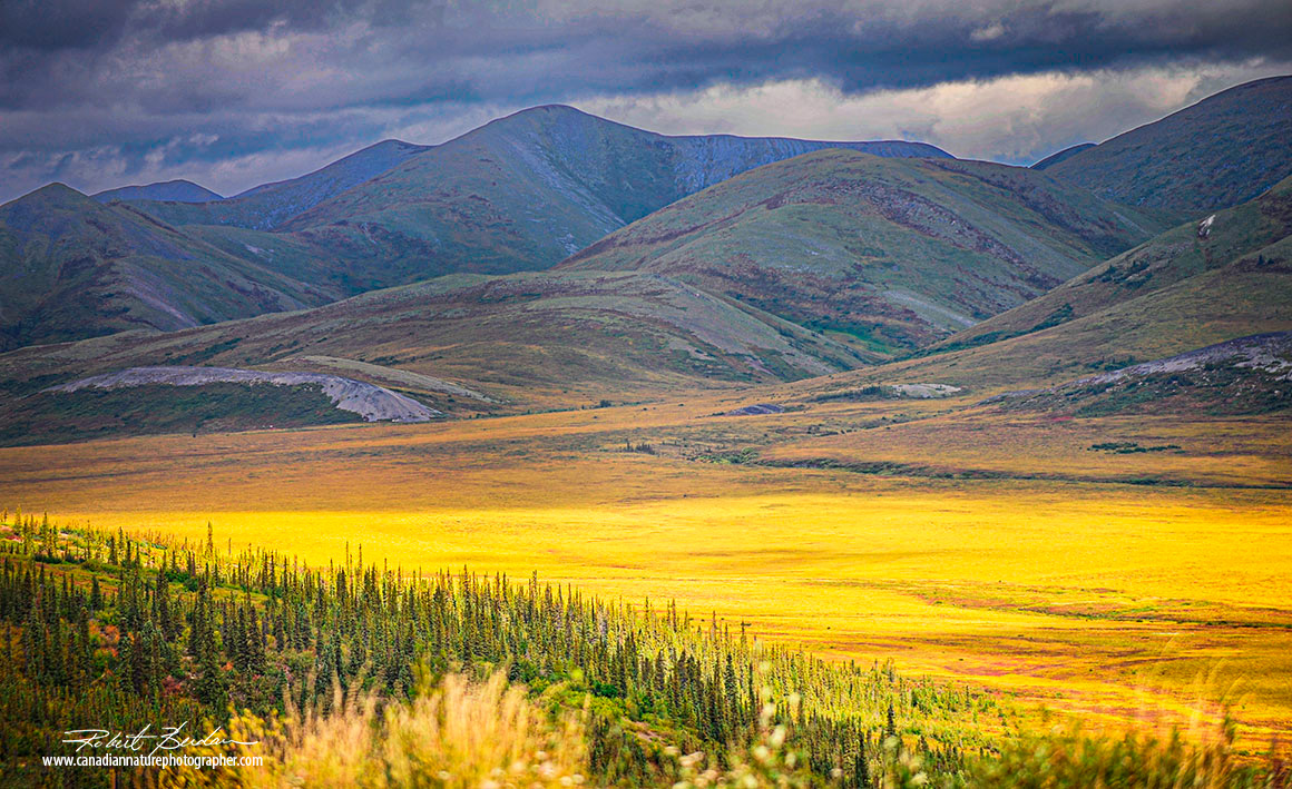
Mountains from the Dempster highway before we reached Eagle Plains.
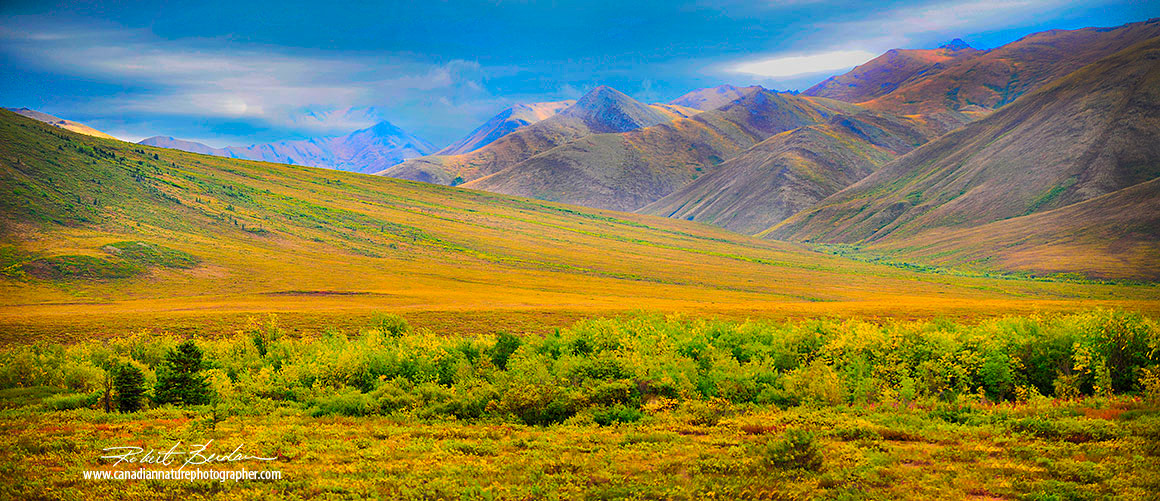
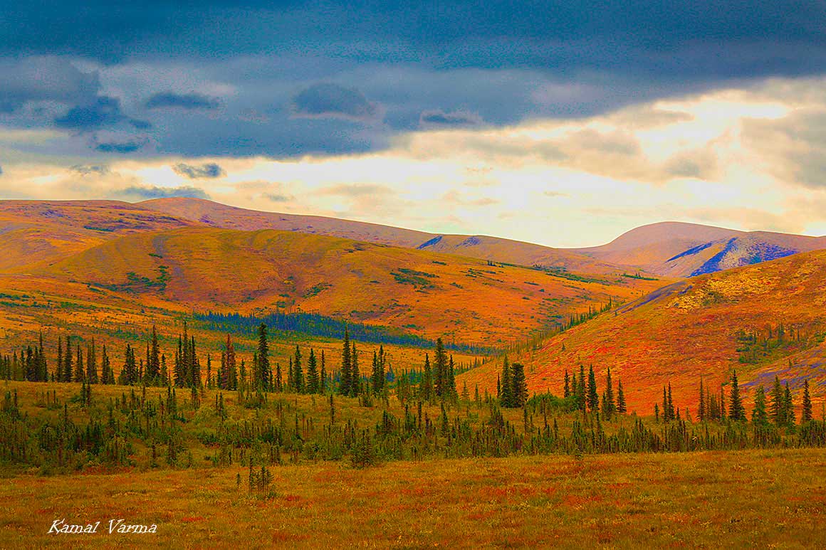
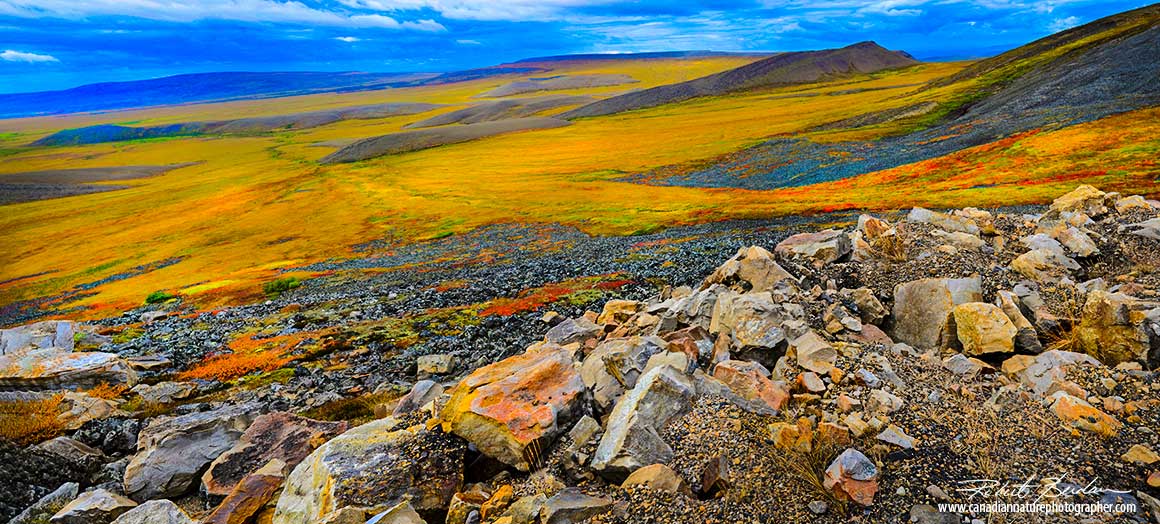
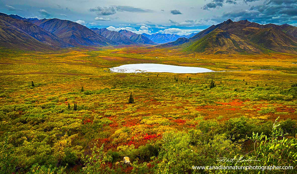
Mountains and tundra adjacent to the Dempster highway.
Before we reached Eagle Plains we drove onto a high plateau with beautiful views of the valley below. Here we encountered the roughest part of the Dempster which consisted of hard cobble stone-like roads that limited our driving speed to 30-40 km\hr.
Eagle Plains Motel
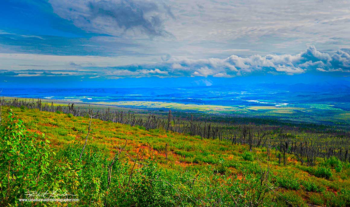
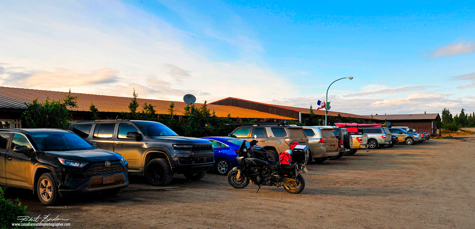
Until we reached Eagle Plains, it was overcast most of the day. The scenery became more interesting after we reached Eagle Plains. Prior to Eagle Plains there were long stretches of road surrounded by boreal forest. We left Dawson City around 7 am and arrived at Eagle Plains around 6 pm. We immediately filled the jeep with gas, checked in and had dinner. One person checked us in, and also operated the restaurant and the bar. He was pleasant and it was obvious that employees were required to work several jobs. Eagle Plains Motel has 32 rooms and can accomodate 64 people. Staff at the motel are able to repair tires and fix minor vehicle problems. There was a parking lot next to the motel for trailers, trucks and camper vehicles and around the back of the motel is a nice view of the tundra to the west.
Breakfast at Eagle Plains is served at 7:00 am. Overall the service and food was good. If you don't sleep in your vehicle, you won't have any other opportunities for accomodation until Inivuk. The Arctic Circle marker was about 30 minutes north of Eagle Plains.
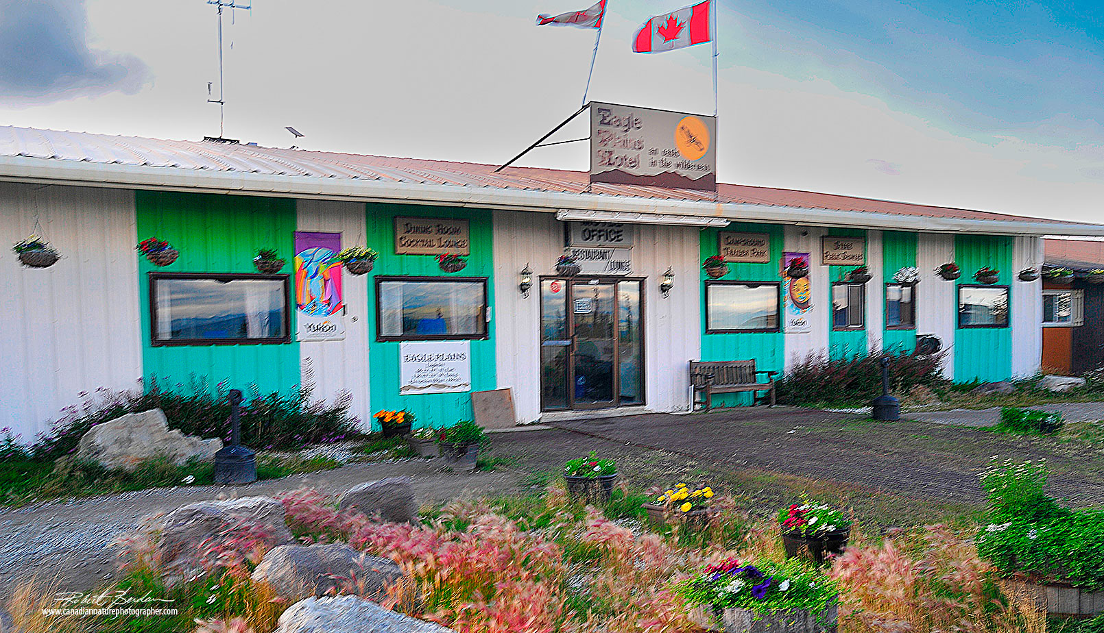
Motel at Eagle Plains accomodates 64 people and offers breakfast, lunch and dinner.
It is strongly advised to make reservations well in advance of arriving for accomodation in Eagle Plains. Population 8 or 9 staff members.
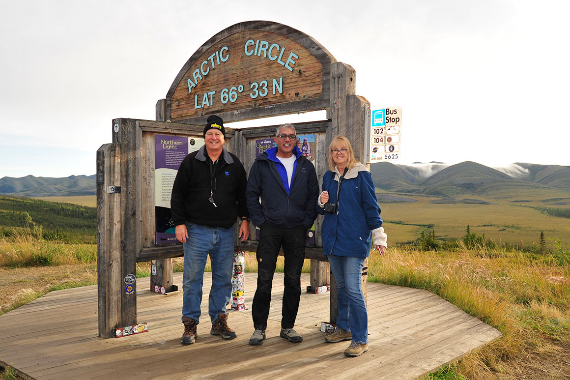
About 20 km north of Eagle Plains is a marker for the position of the Arctic circle. Left to Right, Robert Berdan, Kamal Varma and Donna Berdan. Most folks stop to take a picture at the arctic circle marker.
View of mountains and tundra behind the Arctic circle marker.
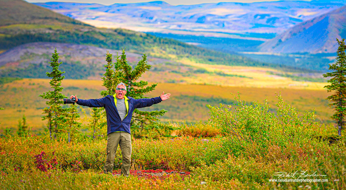
Kamal Varma excited about reaching the Arctic circle.
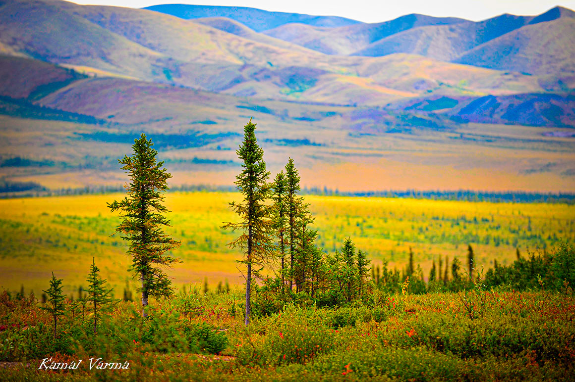
Tundra around the Arctic circle was colourful. This photo was taken on our way back.
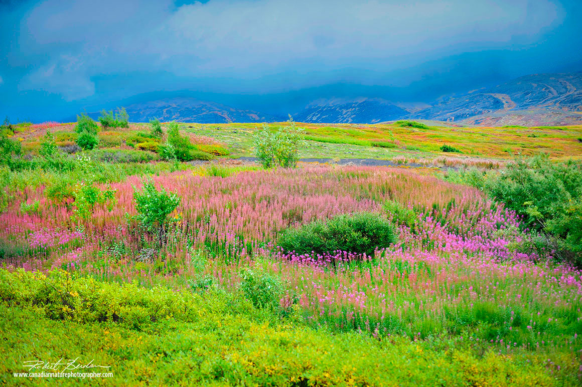
Fireweed grows next to the Dempster in several places and added a splash of pink to the landscape before Inivuk.
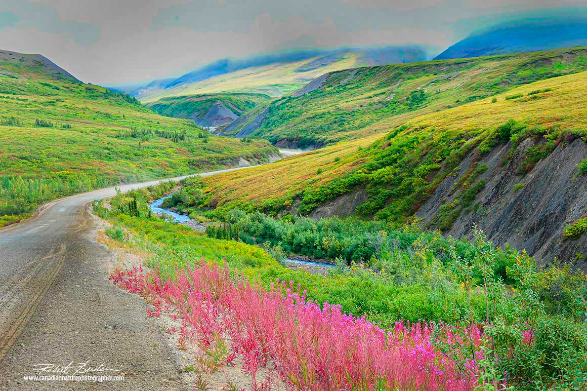
Fireweed beside the road as we passed through a narrow valley with mountans on each side.
Rolling hills with boreal forest next to the Dempster on our way from Inivuk.
View of the tundra from Wright pass. Wright Pass is a significant point on the Dempster Highway, marking the border between Yukon and the Northwest Territories within the Richardson Mountains.
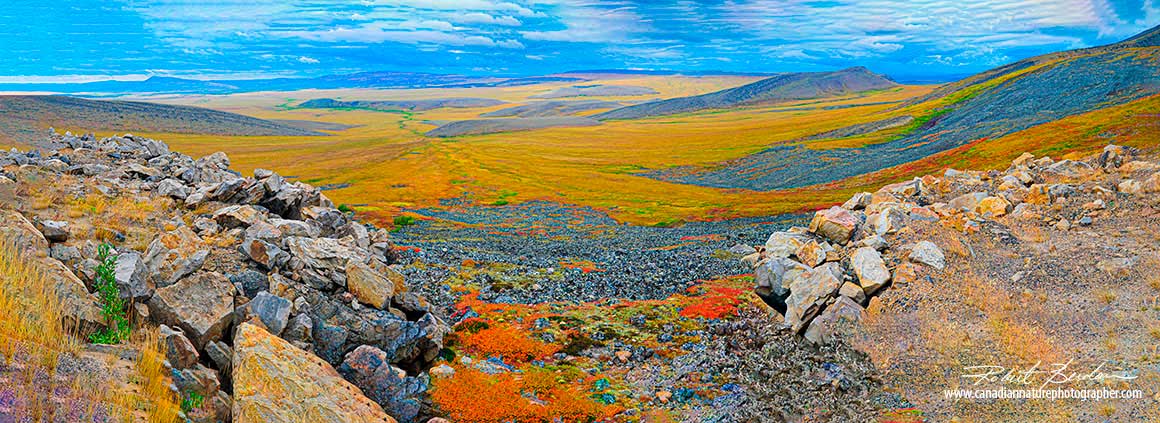
Wright Pass is a high point on the Dempster highway perfect for taking panoramic photos. It is located at Kilometer 464 on the Dempster Highway, just before the Yukon/NWT border.
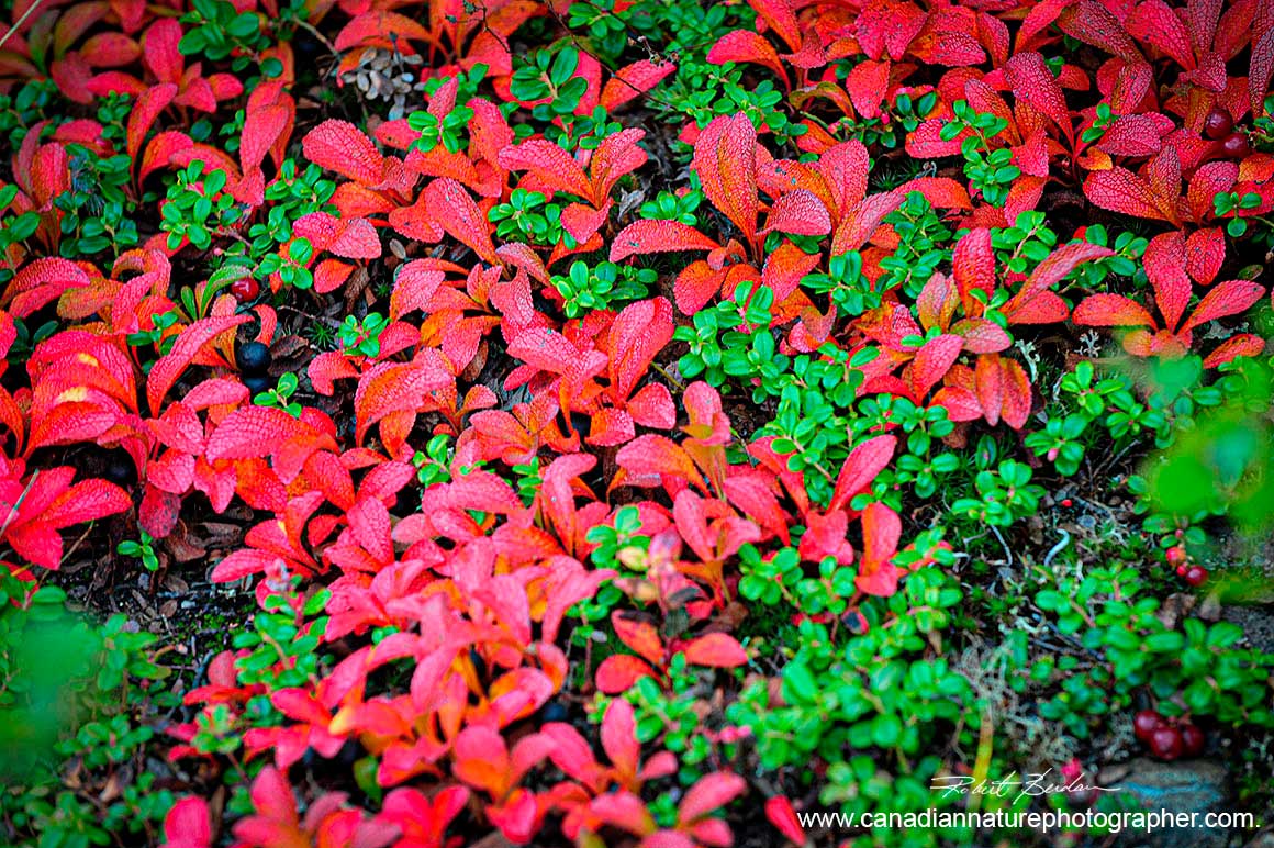
Bearberry forms bright red patches on the tundra and is found along most of the Dempster.
Small lake, tundra and bearberries in the foreground, photographed next to the Dempster.
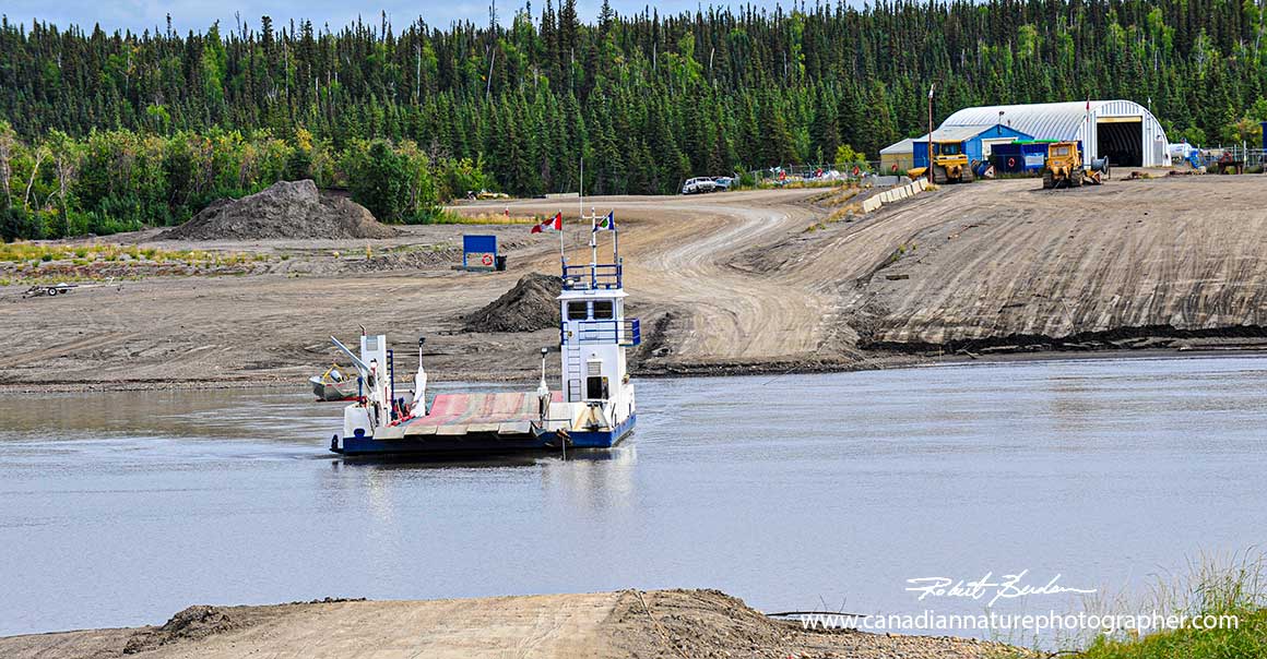
We stopped for bite to eat at Fort McPherson which is on the East bank of the Peel river 121 km south of Inivuk. The ferry is a short 10 min crossing with the ferry pulled by cables.
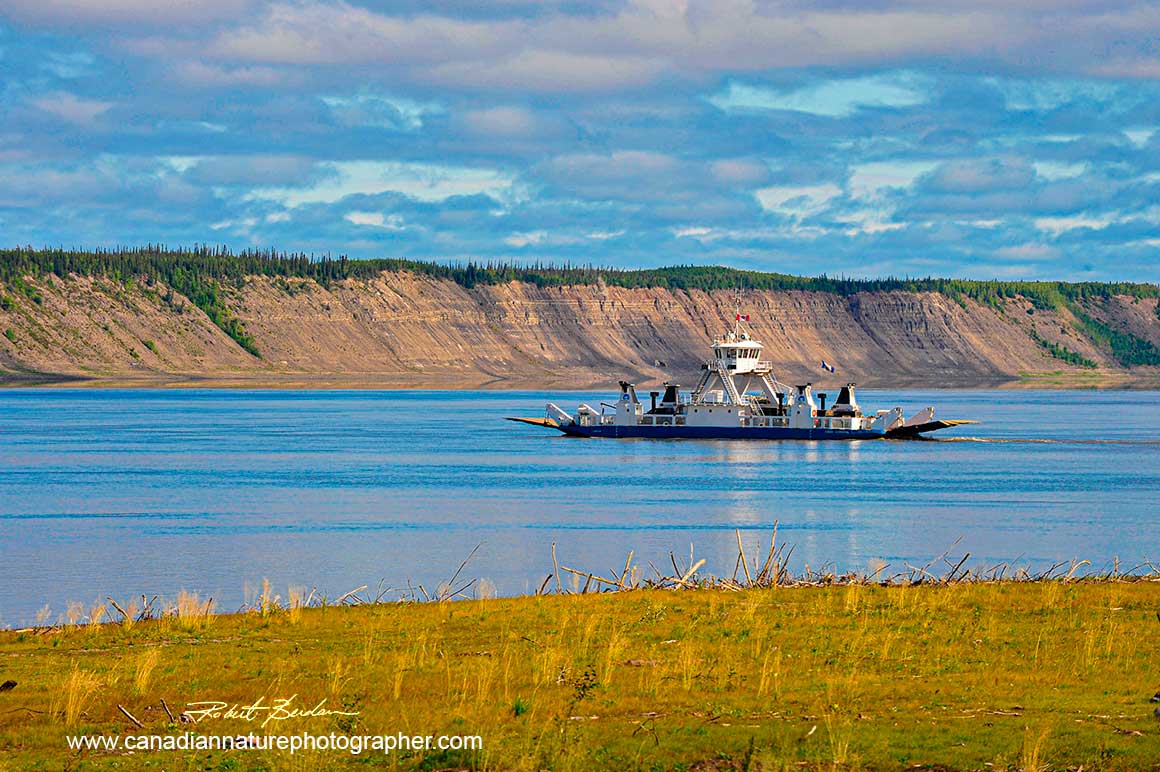
We reached a second ferry at Tsiigehtchic a small community of about 300. This Mackenzie river ferry is accessible all year with the exception of spring break-up and fall. It is known historically as the principal Hudson's Bay Company Trading post for over 50 years. In the winter an ice road crosses and follows the Mackenzie all the way north to the Arctic Ocean. Inuvik, the last village on the Dempster Highway is about a two-hour drive north of here.
Inuvik
Eagle Plains to Inuvik is approximately 370 km (230 miles), a journey along the Dempster that takes about 6-7 hours without stops. This was one of the most scenic sections of the Dempster. Inuvik is located on the northern edge of the boreal forest. The Inuvik to Tuktoyaktuk highway, was the first road in history to reach the Arctic Ocean in North America. Inivuk has a population of about 3000 and two thirds of the inhabitants are indigenous. Inuvik is serviced by a small airport, a hospital, several gas stations and a grocery store. We experienced about 20 hours of daylight while we were there. We also enjoyed the most delicious fish and chips at Alestines Restaurant - see below.
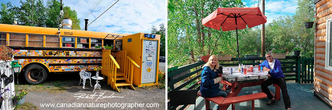
Alestines Fish and Chips, served their food from a school bus was one of the best places to eat in Inivuk.
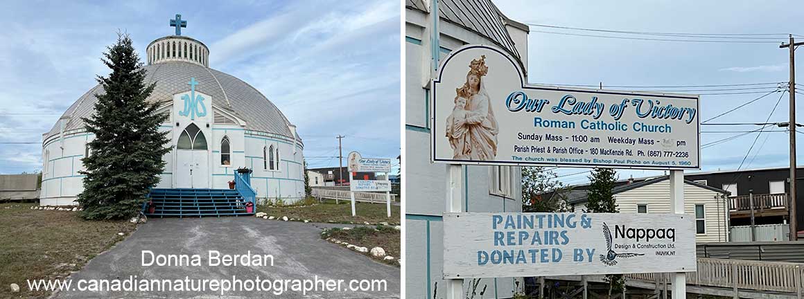
Inuvik's Our Lady of Victory Church, often called Igloo Church, is a famous landmark in the region. It is the most-photographed building in the town (Wikipedia). We stayed at a rental apartment next to the Church, which was also close to a grocery store and a hotel across the street.
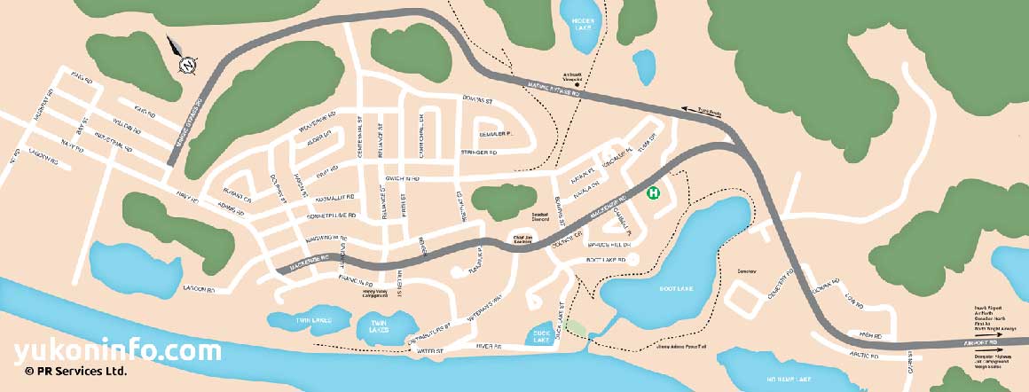
Map of Inivuk. To see a larger map visit https://yukoninfo.com/inuvik-nwt/maps-of-inuvik/).
Tuktoyaktuk
Each community we stoped along the route had its own charm, but Dawson city and Inuvik were our favorites. Tuktoyaktuk was interesting because of the Pingos and the Arctic ocean. We dipped our feet in the ocean, sampled the food and after a few hours headed back to Inuvik. The only place to eat in Tuktoyaktuk was at Grandma's Kitchen that serves food unique to this region along with burgers and fries. It opens at 1 pm.
Robert collected some ocean samples to view with his microscopes, but unlike our previous trip to Newfoundland, he didn't find any interesting specimens. The information center in Tuktoyaktuk was closed when we arrived. We had hoped to be able to get closer to the Pingos.
In 1950 Tuktoyaktuk became Canada's first Indigenous settlement to reclaim its traditional name - Tuktoyaktuk. Hunting caribou occurs in the autumn, ducks and geese in both spring and autumn, while fishing takes place all year-round. Other activities include collecting driftwood, berry picking, and reindeer herding. Most productivity today comes from tourism and transportation. The population is about 1000. Tuktoyaktuk is predominately Indigenous (90.8%) with Inuit (Inuvialuit) making up 88.0%, 9.2% non-Aboriginal, and 1.7% First Nations. There is a small health centre in town.
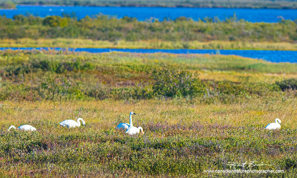
Tundra Swans next to the road into Tuktoyaktuk.
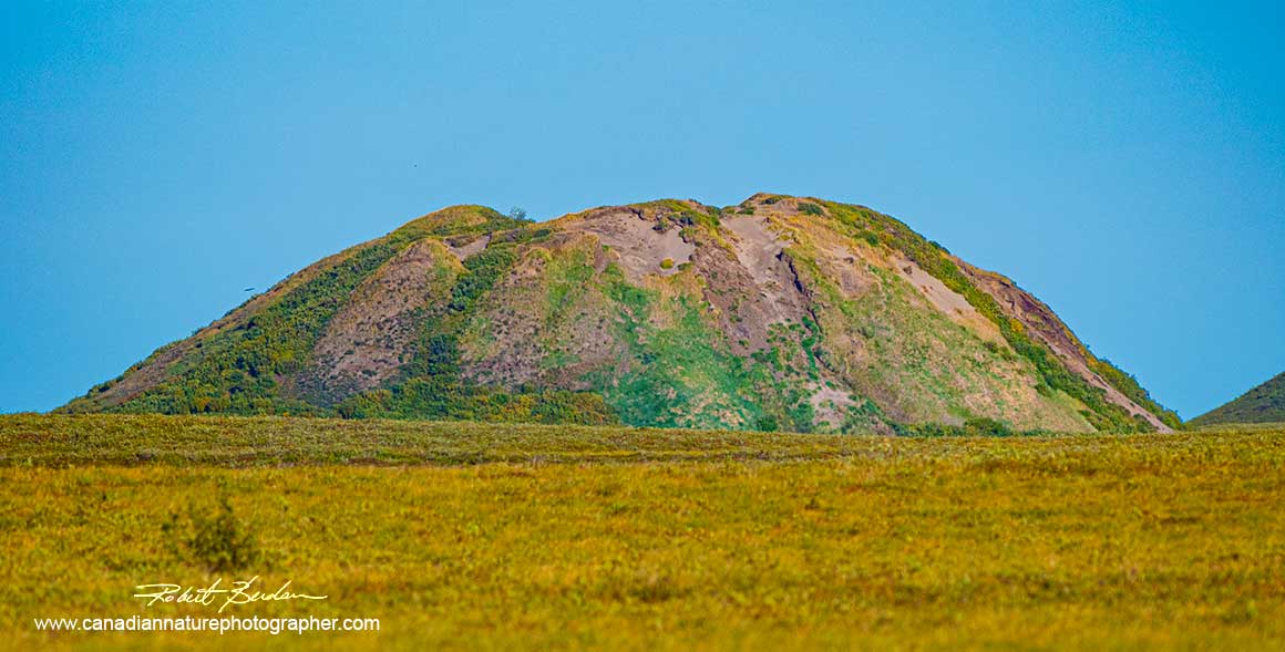
Pingo photographed beside the road with a telephoto lens near the entrance to Tuktoyaktuk.
When we first came into Tuktoyaktuk, the Internet was down and to our surprise the first gas station could not pump gas when the Internet was interrupted. We did find an alternative gas station and filled up. The road to Tuktoyaktuk was relatively smooth. The road was under construction and very dusty. So much dust got into the jeep that we needed to clean it when we got back to Inivuk. We saw swans in ponds along the roads, black bears around the ferries and lots of temporarily abandoned snow mobiles, presumably used for hunting in winter. Trees around town were short or absent.
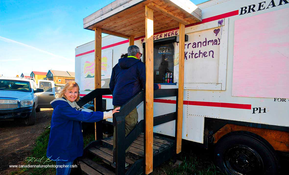
Buying lunch at Grandma's Kitchen - the only place serving food in Tuktoyaktuk.
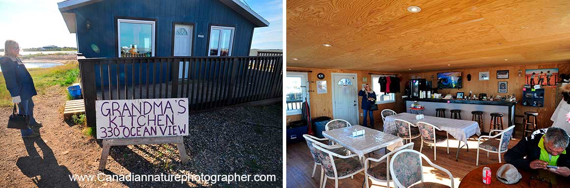
Grandma's Kitchen included a shelter on the ocean, outside and inside.
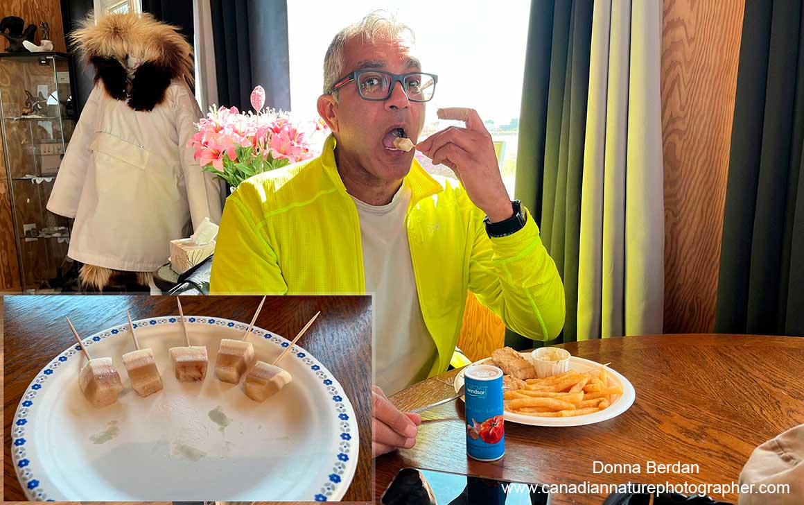
Kamal tasting the local cuisine - Muktuk bites. Grandma's kitchen opens 1 pm and is cash only. It's a comfortable place to eat and we enjoyed views of the Arctic ocean and pingos. It's the only place that serves food in town.
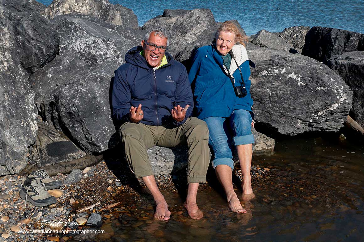
Kamal and Donna dipping their feet into the Arctic ocean.
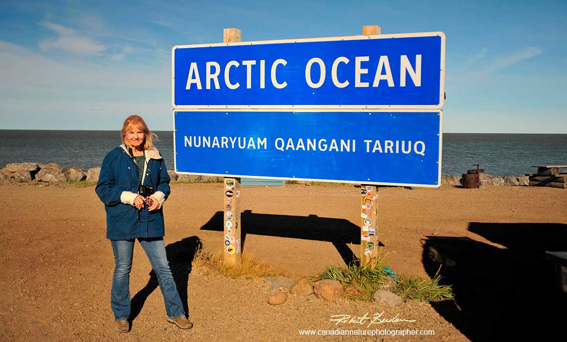
Donna in front the Arctic ocean sign in Tuktoyaktuk.
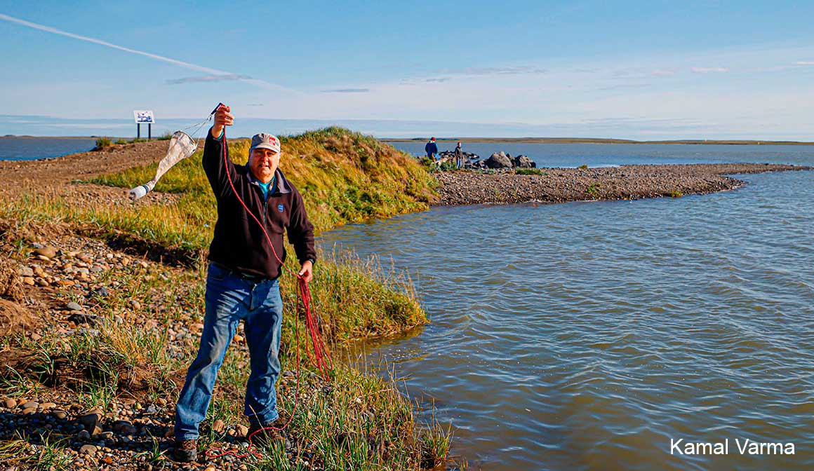
Robert swinging a plankton net to collect specimens from the ocean for microscopy.
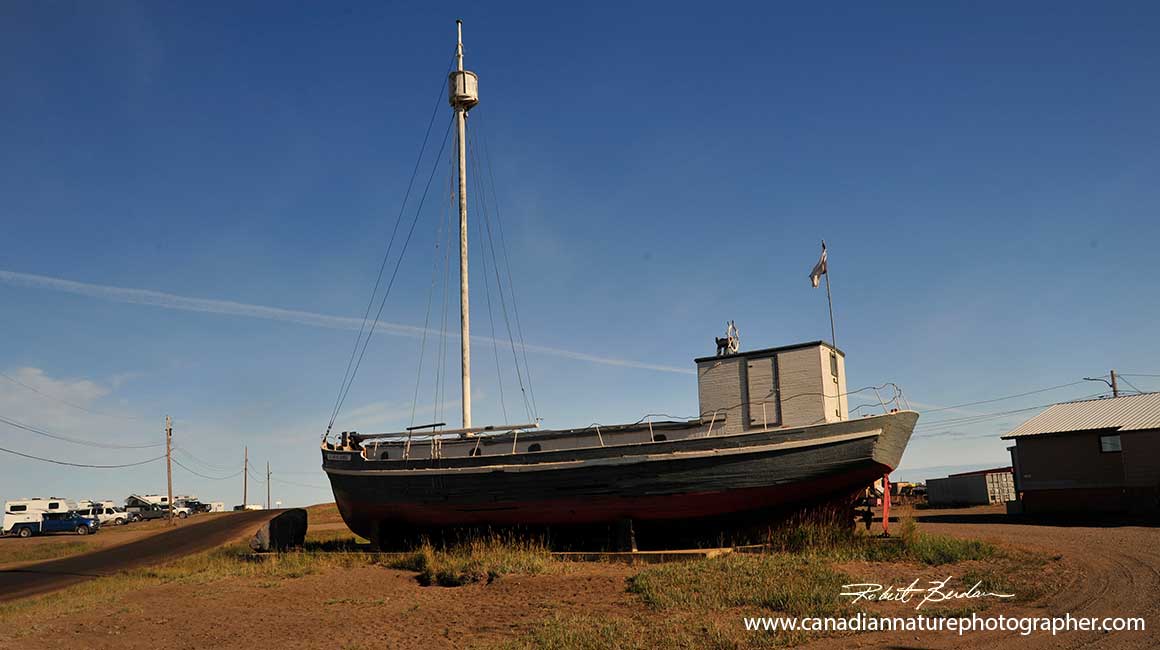
Boat in repair in Tuktoyaktuk
Dawson City
Our favorite community on the trip North was Dawson city where we spent one night on the way north and one day on our way back. Dawson City is a small town in the Yukon with a population of around 1600. The town formed in 1896 in response to the Klondike Gold Rush. The town is still involved in extracting gold in the area, it features a small airport and offers the opportunity to pan for gold. A gold-panning site is set aside for tourists where they can try their luck. The town drops off sediment near a small creek. The sediment is produced by a dredge and tourists can purchase a pan in town for about $5. We found about half a dozen folks trying it. None of us found any gold, but it was a thrill to give it a try.
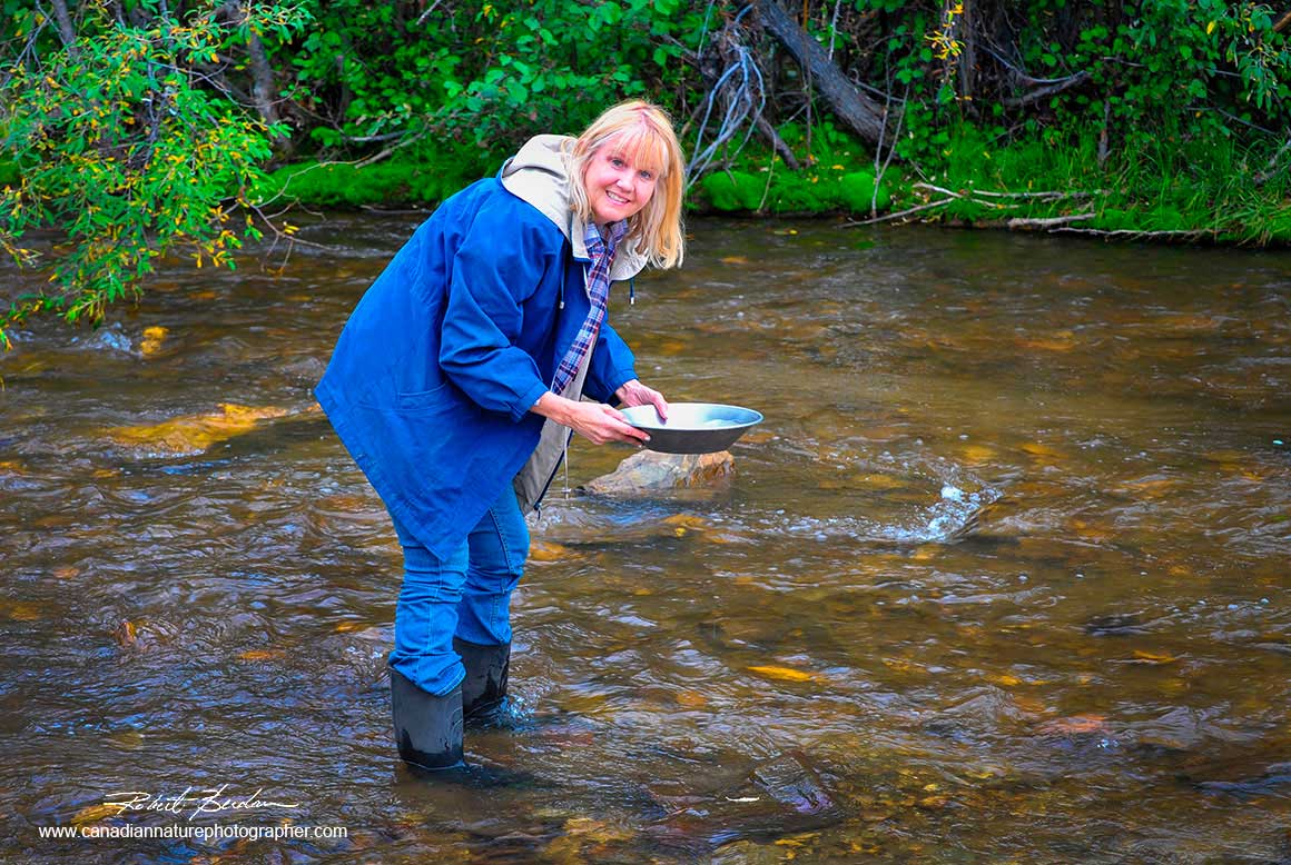
Donna panning for gold in Bonanza creek in Dawson city. Donna discovered it takes a lot of patience and you may not find any gold.
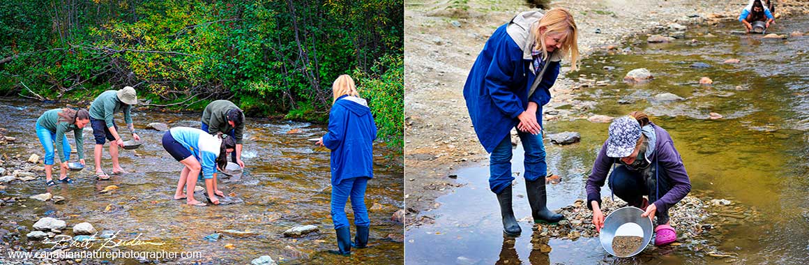
Left: Other tourists panning for gold Right: Maya was from BC. She was demonstrating how to properly pan for gold using some of the nearby sediment left by the town.
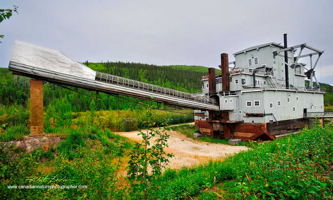
One of the early dredges used to collect sediment in the search for gold.
Dredges used in Dawson City were large, mechanized gold-digging machines that were electrically powered and dug for gold-bearing gravel in the Klondike Valley and on Bonanza Creek. The most famous example is Dredge No. 4, a National historic site, which was one of the largest wooden-hulled bucket dredges in North America and operated from 1912 until 1959. These machines sifted gold from gravel using a system of buckets and screens.
Dawson City contained numerous restored and original buildings. As we drove into town we saw mounds of worm-like structures from dredging around Dawson City. There is also a side road that took us to a look out above the town.
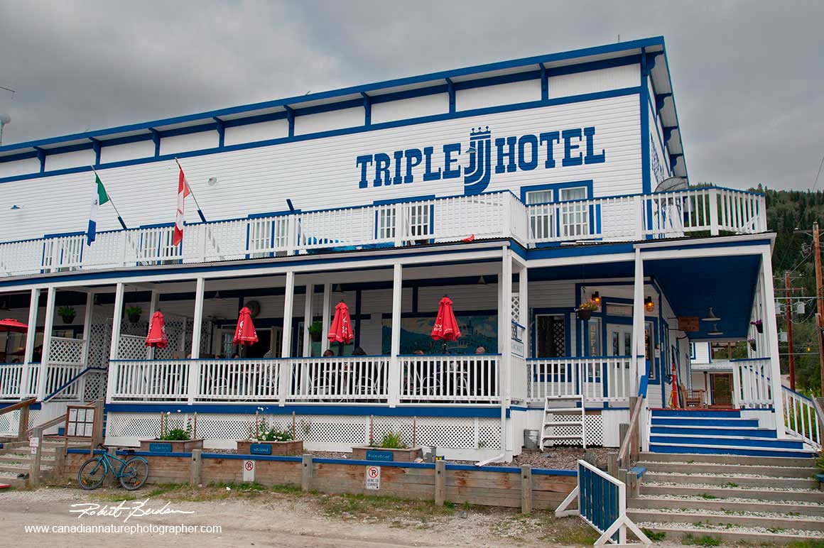
Triple J motel where we stayed overnight and ate meals.
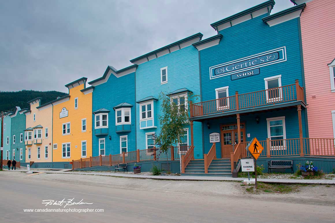
Some of the restored buildings in Dawson city form colourful rows.

Gertie and her saloon girls put on a show at a local Casino in Dawson city.
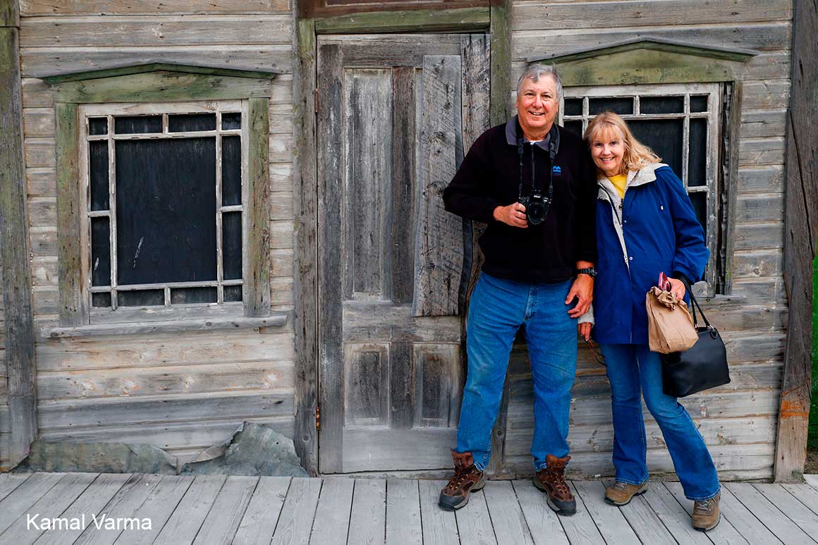
Robert and Donna in front of an original building still standng from the Gold rush days.
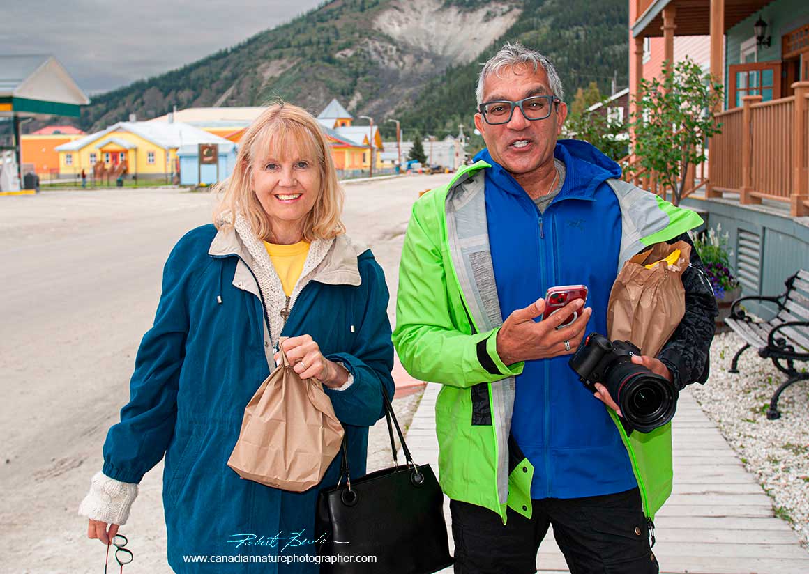
Donna and Kamal after shopping in Dawson city.
The entrance of the Dempster is 40 km outside of Dawson City where there is an automated gas pump. There are a few buildings but no store, only a couple of porta-pot washrooms. This will be your last chance for gas before you get to Eagle Plains on the Dempster.The gas pump is available 24 hours a day - be sure to have your credit card with you. Also be sure to have some cash with you as some stores only accept cash further north. The return trip from the start of the Dempster until Eagle Plains is 365 km.
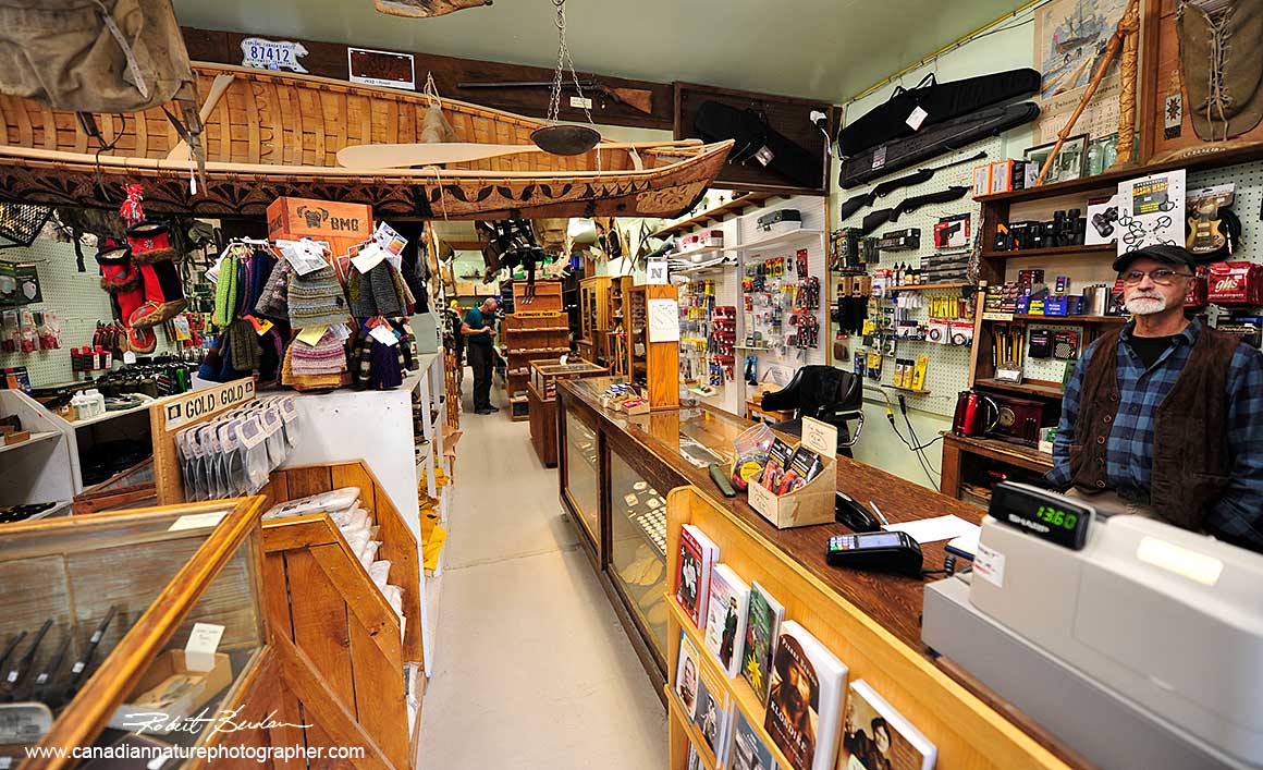
Dawson Trading post, the gentlemen on the right has worked here for over 40 years. We purchased our "gold pan" here. The store is on the main street which features a Farmer's market on Saturdays along with several other stores including stores for ice cream and souvenirs.
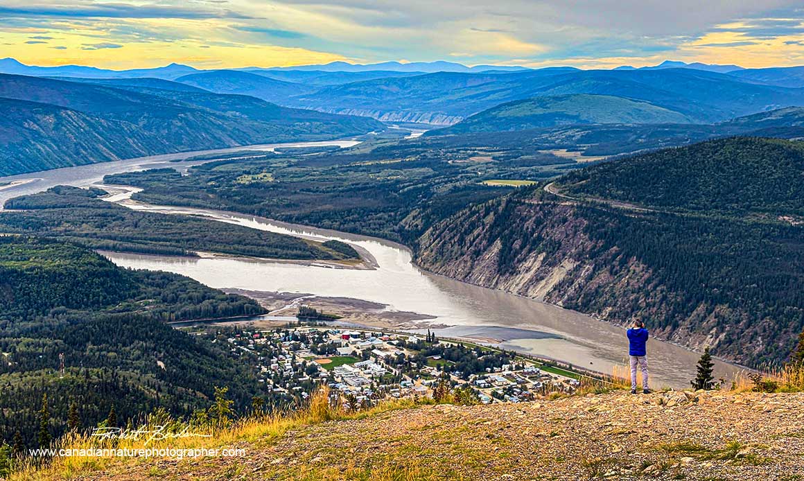
A short drive on the way out of Dawson to the Midnight Dome brings you to an overlook where you can see the Yukon River and Dawson City below. Kamal is taking a photo on the overlook over Dawson City.
From Dawson City and futher north on the Dempster highway the scenery became more interesting with mountains, rivers and vast expanses of the tundra along the road. Some parts of the Dempster had large pot holes you need to watch out for. We photographed a car that had slid into the ditch beside the Dempster with a sign "we are in Dawson City". We saw a tow truck pulling the car out of the ditch a few days later while we were on our way back. Tow trucks can be expensive if you need one. We recommend having satellite phone coverage, many cell phone providers now offer this feature. Also the road can be very rough in places. We usually drove about 30-70 km along the Dempster which will be easier on your vehicle and safer.
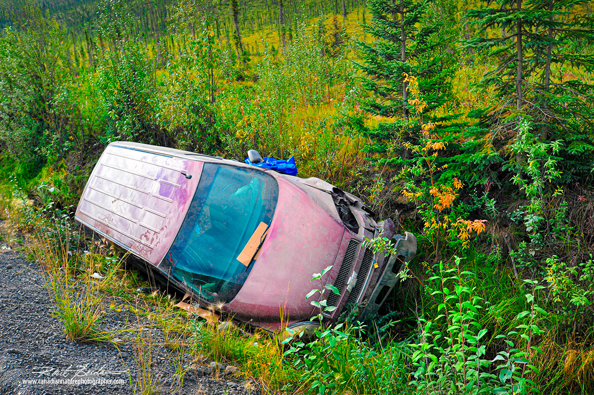
One of the vehicles we passed that had driven into the ditch along the Dempster.
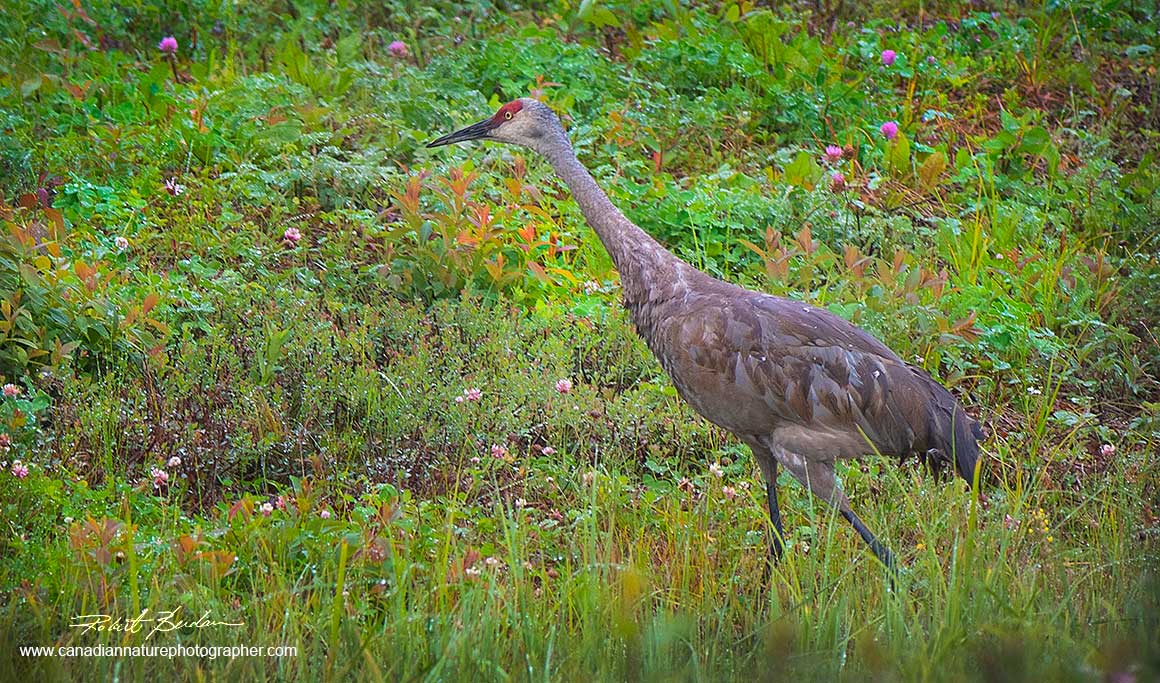
Sandhill crane photographed along the highway north of Fort Nelson
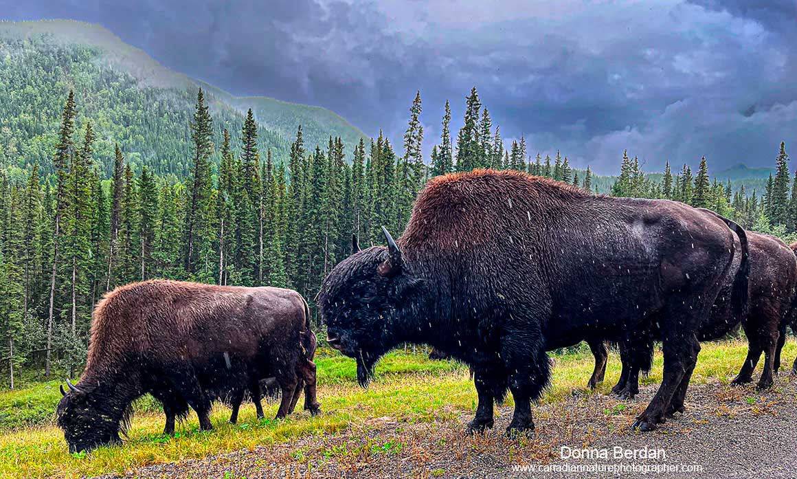
Bison next to the road in Pink Mountain Provincial Park in BC
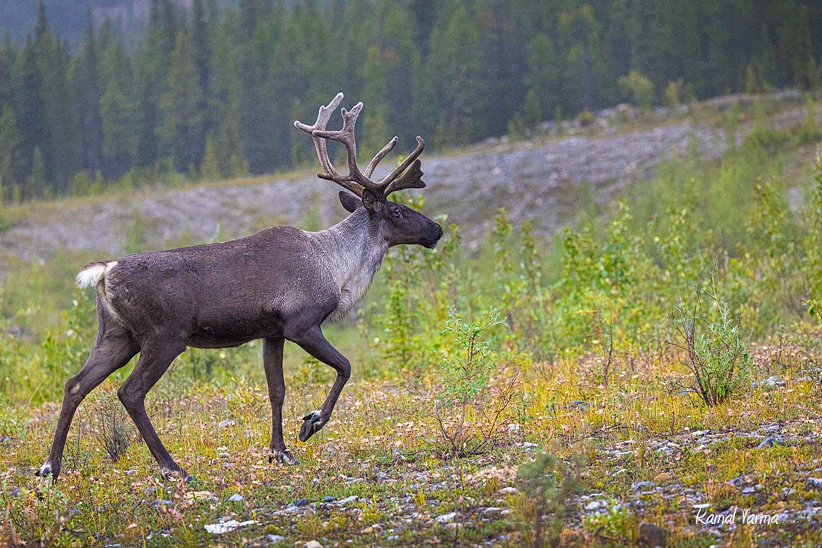
Woodland Caribou next to the highway in Pink Mountain provincial park. This area represents a part of the eastern foothills of the Rocky Mountains.
In Pink Mountain park in BC,
the road climbs high and into the clouds in some parts. The clouds became a fog in our first encounter with only fifty feet of visibility in places. If this road experiences significant snow fall it could become unsafe for driving.
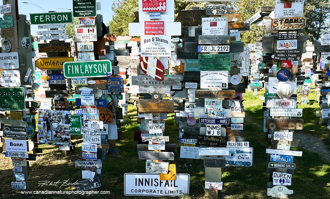
The Sign Forest is a collection of over 90,000 signs located in Watson Lake, Yukon, along the Alaska Highway. It was started in 1942.
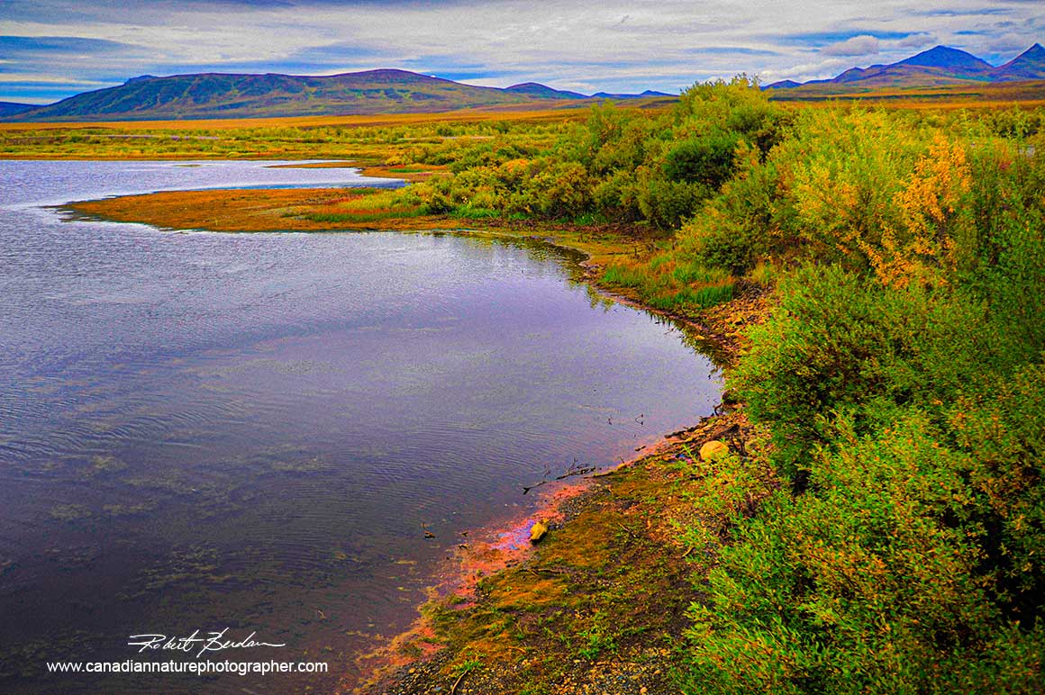
Small pond north of Whitehorse along the Alaska highway
Epilogue
The first part of our drive north of Calgary was uneventful, it rained and we stayed at Buffalo Inn at the Pink Mountains, south of Fort Nelson on our first night. They offered good food and basic accomodations. Northern Alberta consists mostly of farm land and boreal forest. The drive from Fort Nelson to Watson Lake was mostly enclosed within forest, with some Sandhill cranes and Bison next to the road. Driving through the Pink Mountains we photographed a number of Mountain Caribou next to the road.
Whitehorse is a small community with a population of 30,000 and the town was easy to navigate. From there we headed north on the Alaska highway, passed several lakes, but the pavement was narrow in places with little room to pull over. Arriving in Dawson City we stayed at the JJJ Motel and explored the town, we panned for gold and enjoyed the saloon dancers.
When we arrived back in Calgary we all caught a cold - thankfully it was at the end of our trip. This is one trek we will never forget. We saved costs by travelling together and our navigator Kamal has a knack for finding great accomondations at a reasonable price. I think we all agree that there was more driving involved than we had planned on. We admire the perseverance of the people living in the small northern communities in Canada. The people we encountered did their best to make our journey comfortable and memorable. When we do these treks, we always like to talk to the locals and find that we often meet interesting and colourful people that adds to the overall experience. To all these individuals who are living, working, thriving and entertaining visitors in these remote areas, we salute you.
References
K. Frazer (2025) The Ultimate Guide to Driving the Dempster Highway. https://adventuresofaplusk.com/driving-the-dempster-highway
The Dempster Highway - Spectacular Northwest Territories. https://www.dempsterhighway.com/
Dempster Highway road trip Intinerary - The Yukon
https://www.travelyukon.com/en/see-and-do/itineraries/dempster-highway-road-trip-itinerary
Dawson City - The Dempster Highway
https://dawsoncity.ca/drive-the-dempster/
The Dempster Highway Travelogue
https://yukon.ca/sites/default/files/env/env-dempster-highway-travelogue.pdf
The Dempster Highway
https://en.wikipedia.org/wiki/Dempster_Highway
Eagle Plains Hotel
https://eagleplainshotel.ca
Town of Inuvik
https://www.inuvik.ca
Town of Tuktoyaktuk
https://tuktoyaktuk.ca
Tuktoyaktuk PDF
https://www.iti.gov.nt.ca/sites/iti/files/tuktoyaktuk_brochure.pdf
Inuvik-Tucktoyaktuk images and aerial photographs by Tawna Brown
https://www.tawnabrown.com/galleries/inuvik-tuktoyaktuk-highway/
Build it and They Will come U the Inuvk-Tuktoyaktuck Higway - Nov. 10, 207 by Tawna Brown
https://www.tawnabrown.com/build-it-they-will-come-up-the-inuvik-tuktoyaktuk-highway/

Bio: Robert Berdan is a professional nature photographer living in Calgary, AB specializing in nature, wildlife and science photography. Robert retired from Cell\Neurobiology research to pursue photography full time years ago. Robert offers photo instruction ain all aspects of nature photography, Photoshop training, photomicrography and macro-photography. Portrait of Robert by Dr. Sharif Galal showing some of Robert's research in the background.
Email at: rberdan@scienceandart.org
Web sites: www.canadiannaturephotographer.com www.scienceandart.org
Phone: MST 10 am -7 pm (403) 247-2457.